Mine Index Number: 2953
| Company Name:
|
Spring Lake Coal Company
|
| Mine Name:
|
Spring Lake No. 1 Mine
|
| Start Date:
|
1899
|
End Date:
|
1918
|
| Type of Mine:
|
Underground
|
| Total acres shown:
|
None
|
| Production Indicated Acres:
|
16
|
General Area of mining acres shown:
|
|
|
|
Shaft, Slope, Drift or Tipple Location(s)
| Type
|
County
|
Township-Range
|
Section
|
Part Section
|
| Main shaft
|
La Salle
|
31N 3E
|
21
|
NE NE
|
Geology
| Colchester
|
187-190
|
|
|
2.67-3.0
|
LW (old longwall)
|
Geological Problems Reported
Production
| Company
|
Mine Name
|
Date
|
Production (tons)
|
|
|
|
|
|
| Total Production: 161,650
|
Production Notes
Coal Report production (if available)
Sources of Data
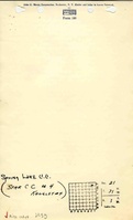
| Mine notes (sketch)
|
Undated
|
1:62500
|
1:24000
|
Secondary source
|
Annotated Bibliography (Data source - brief description of information)
| Coal Reports - Production, ownership, years of operation, mining method.
|
| Directory of Illinois Coal Mines (La Salle County) - Mine names, mine index, ownership, years of operation.
|
| Mine notes (La Salle County) - Mine type, shaft location, seam, depth, thickness, geologic problems, mine outline.
|
Mine Notes
Mine Images
Photographs