Mine Index Number: 0754
| Company Name:
|
Acme Coal Company
|
| Mine Name:
|
Acme No. 1 Mine
|
| Start Date:
|
1892
|
End Date:
|
April 1914
|
| Type of Mine:
|
Underground
|
| Total acres shown:
|
199
|
| Acres after map date:
|
|
General Area of mining acres shown:
|
|
|
The area shown on the accompanying map is too small for the reported production. Production indicates approximately 375 acres were mined.
|
Shaft, Slope, Drift or Tipple Location(s)
| Type
|
County
|
Township-Range
|
Section
|
Part Section
|
| Main shaft
|
La Salle
|
31N 4E
|
31
|
SE NW NW
|
| Air shaft
|
La Salle
|
31N 4E
|
31
|
SE NW NW
|
Geology
| Herrin
|
106-110
|
|
|
4.4-6.5
|
MRP
|
Geological Problems Reported
Rolls were common. There were several small clay bands within the seam that extended throughout the mine. Each band varied in thickness. A washing plant was necessary to clean the product.
Production
| Company
|
Mine Name
|
Date
|
Production (tons)
|
|
|
|
|
|
| Total Production: 2,027,724
|
Production Notes
Coal Report production (if available)
Sources of Data
| Microfilm, mines074.tif
|
1898
|
1:1200
|
1:1200
|
Not final
|
| Microfilm, mines0b1.tif and mines0b2.tif
|
7-31-1903
|
1:1200
|
1:2148
|
Not final
|
| Microfilm, mines051.tif
|
5-1913
|
1:1200
|
1:1416
|
Not final
|
| Microfilm, mines079.tif
|
1-22-1914
|
1:1200
|
1:1440
|
Not final
|
| Microfilm, document 352420
|
5-7-1915
|
1:1200
|
1:1655
|
Secondary source
|
Annotated Bibliography (Data source - brief description of information)
| Coal Reports - Production, ownership, years of operation, depth, thickness.
|
| Directory of Illinois Coal Mines (La Salle County) - Mine names, mine index, ownership, years of operation.
|
| Mine notes (La Salle County) - Mine type, shaft location, geologic problems.
|
| Microfilm, Coal Section files, mines074.tif - Slope & air shaft.
|
| Microfilm, Coal Section files, mines0b1.tif and mines0b2.tif - Mine outline, mining method.
|
| Microfilm, Coal Section files, mines051.tif - Mine outline (northern and western part).
|
| Microfilm, Coal Section files, mines079.tif - Mine outline (partial, eastern and southern part).
|
| Microfilm map, document 352420, reel 03139, frame 92, map of Munts Mine (mine index 2644) - Mine outline (northeastern part).
|
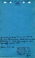
Mine Notes
Mine Images
Photographs