Mine Index Number: 2033
| Company Name:
|
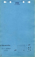
Alphonse Vermuele
|
| Mine Name:
|
Vermuele Mine
|
| Start Date:
|
1920
|
End Date:
|
1925
|
| Type of Mine:
|
Underground
|
| Total acres shown:
|
None
|
| Acres after map date:
|
Less than 2
|
General Area of mining acres shown:
|
|
|
Not shown on accompanying map due to later surface mining by Midland Mine (mine index 681).
|
Shaft, Slope, Drift or Tipple Location(s)
| Type
|
County
|
Township-Range
|
Section
|
Part Section
|
| Main shaft
|
Bureau
|
16N 6E
|
29
|
S 1/2 NE SE
|
Geology
| Herrin
|
51
|
4.0
|
5.17
|
4.67
|
Underground
|
Geological Problems Reported
The shaft was located near the center of a dip. At the shaft, the coal dipped to the north and west. About 100 yards south of the shaft, the coal elevation rose to the south. Horsebacks were common near the shaft as well, and less frequent in occurrence in the other parts of the mine. The cap rock was a 3 to 7 foot thick limestone above 4 to 4.5 feet of black shale. In some areas, the roof was white top, where the coal-roof contact was clean and the roof held better than the black shale. The black shale adhered to the coal and the top tended to come down when the coal was removed. Impurities in the seam included pyrite lenses and calcite on fracture facings.
Production
| Company
|
Mine Name
|
Date
|
Production (tons)
|
Production Notes
The Coal Reports listed Alphonse Vermeulen only once per year from 1919-1925. The production has been included with mine index 2033, as there are mine notes of a visit to the mine in this location (S 1/2 NE SE 29-T16N-R6E) where ISGS personnel had spoken to Mr. Vermeulen. It is just as likely that the production listed for mine index 2033 rightly goes to mine index 7815 (NE NE 27-T16N-R6E), and it is possible that the production included both mines.
Coal Report production (if available)
Sources of Data
| Federal Land Bank Report
|
6-1935
|
1:126720
|
1:126720
|
Secondary source
|
Annotated Bibliography (Data source - brief description of information)
| Coal Reports - Production, ownership, years of operation.
|
| Directory of Illinois Coal Mines (Bureau County) - Mine names, mine index, ownership, years of operation.
|
| Mine notes (Bureau County) - Mine type, shaft location, seam, depth, thickness, geologic problems.
|
| Federal Land Bank Report (Bureau County) - Shaft location, mine type, ownership.
|
Mine Notes
Mine Images
Federal Land Bank Report:
Map Date: 6-1935
Coal Co.: John Enders
Mine Name: Indian Hill Mine
Photographs