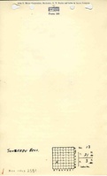
Mine Index Number: 2581
| Company Name:
|
Thomas Sowerby & Brothers
|
| Mine Name:
|
Sowerby Mine
|
| Start Date:
|
1895
|
End Date:
|
1901
|
| Type of Mine:
|
Underground
|
| Total acres shown:
|
None
|
| Production Indicated Acres:
|
3
|
General Area of mining acres shown:
|
|
|
|
Shaft, Slope, Drift or Tipple Location(s)
| Type
|
County
|
Township-Range
|
Section
|
Part Section
|
| New shaft
|
La Salle
|
31N 3E
|
13
|
SE NW SW
|
| Old shaftThe Coal Report indicated the old mine was abandoned and a new mine was opened 1/4 mile south.
|
La Salle
|
31N 3E
|
13
|
SE SE SW
|
Geology
Geological Problems Reported
Production
| Company
|
Mine Name
|
Date
|
Production (tons)
|
Production Notes
Coal Report production (if available)
Sources of Data
| ISGS map library, 4103.L32 i5.1-23
|
Undated
|
1:12069
|
1:12069
|
Secondary source
|
Annotated Bibliography (Data source - brief description of information)
| Coal Reports - Production, ownership, years of operation, shaft location (old), mine type, depth, thickness, mining method.
|
| Directory of Illinois Coal Mines (La Salle County) - Mine names, mine index, ownership, years of operation.
|
| Mine notes (La Salle County) - Shaft location.
|
| ISGS map library, 4103.L32 i5.1-23, map of Streator Coal Field - Shaft location (new).
|
Mine Notes
Mine Images
Photographs