Mine Index Number: 2638
| Company Name:
|
Piney Coal Company
|
| Mine Name:
|
Piney Mine
|
| Start Date:
|
1881
|
End Date:
|
1899
|
| Type of Mine:
|
Underground
|
| Total acres shown:
|
None
|
| Production Indicated Acres:
|
1
|
General Area of mining acres shown:
|
|
|
|
Shaft, Slope, Drift or Tipple Location(s)
| Type
|
County
|
Township-Range
|
Section
|
Part Section
|
| Main shaft
|
La Salle
|
31N 4E
|
18
|
SE SE SW
|
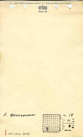
| Air shaft Old Beneckindorf mine hoist shaft, whose location is not known
|
La Salle
|
31N 4E
|
|
|
Geology
| Herrin
|
65-78
|
|
|
4.0-5.5
|
Underground
|
Geological Problems Reported
Production
| Company
|
Mine Name
|
Date
|
Production (tons)
|
| Piney Coal Company
|
Piney
|
1897-1899Piney Coal Company opened a new mine on the Beneckindorf farm and used the old hoist shaft for their air shaft, indicating the underground works were connected.
|
1,025
|
|
|
Production Notes
Coal Report production (if available)
Sources of Data
| ISGS map library, 4103.L32 i5.1-23
|
Undated
|
1:12069
|
1:12069
|
Secondary source
|
Annotated Bibliography (Data source - brief description of information)
| Coal Reports - Production, ownership, years of operation, mine type, depth, thickness.
|
| Directory of Illinois Coal Mines (La Salle County) - Mine names, mine index, ownership, years of operation.
|
| Mine notes (La Salle County) - Shaft location.
|
| ISGS map library, 4103.L32 i5.1-23, map of Streator Coal Field - Shaft location.
|
Mine Notes
Mine Images
Photographs