Mine Index Number: 2668
| Company Name:
|
Caledonia Coal Company
|
| Mine Name:
|
Caledonia Mine
|
| Start Date:
|
1870
|
End Date:
|
1884
|
| Type of Mine:
|
Underground
|
| Total acres shown:
|
None
|
| Production Indicated Acres:
|
8-15the reported production indicates approximately 8 to 15 acres were mined (depending on whether the mine was longwall or room-and-pillar).
|
General Area of mining acres shown:
|
|
|
|
Shaft, Slope, Drift or Tipple Location(s)
| Type
|
County
|
Township-Range
|
Section
|
Part Section
|
| Main shaft
|
La Salle
|
33N 1E
|
3
|
NW NW NW
|
Geology
| Colchester
|
535-565
|
|
|
3.5
|
Underground
|
Geological Problems Reported
Production
| Company
|
Mine Name
|
Date
|
Production (tons)
|
| John Shea and John P. Duncan
|
Caledonia
|
1870-1881
|
UnknownAccording to W. T. Bedford in The La Salle Tribune, 1891-1911, the mine opened in 1870, but production before July 1881 is unknown and the date of transfer of ownership to Mitchell & Duncan is unknown. This source also indicates the mine was bought and dismantled by La Salle County Carbon Coal Company. The 1882 Coal Report indicated that 2 acres were mined, and the 1883 Coal Report listed 8 acres mined. The mine may have operated in higher seams before 1880 and the Coal Report listed only the acreage of the lower coal mined. No maps survive of this mine, and the shaft location was not shown on the 1876 Atlas of La Salle County. Mine index 7076 (see the back of this report under “Other Mines Shown on the La Salle Quadrangle”) was shown on the 1876 Atlas and operated nearby, and may be related to the Caledonia Mine.
|
|
|
| La Salle County Carbon Coal Company
|
Caledonia
|
1884-1884
|
noneAccording to W. T. Bedford in The La Salle Tribune, 1891-1911, the mine opened in 1870, but production before July 1881 is unknown and the date of transfer of ownership to Mitchell & Duncan is unknown. This source also indicates the mine was bought and dismantled by La Salle County Carbon Coal Company. The 1882 Coal Report indicated that 2 acres were mined, and the 1883 Coal Report listed 8 acres mined. The mine may have operated in higher seams before 1880 and the Coal Report listed only the acreage of the lower coal mined. No maps survive of this mine, and the shaft location was not shown on the 1876 Atlas of La Salle County. Mine index 7076 (see the back of this report under “Other Mines Shown on the La Salle Quadrangle”) was shown on the 1876 Atlas and operated nearby, and may be related to the Caledonia Mine.
|
|
|
Production Notes
Coal Report production (if available)
Sources of Data
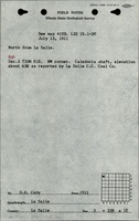
| ISGS field notes (G. H. Cady)
|
7-13-1911
|
1:62500
|
(text only)The mine location was plotted on a 1:24000 USGS topographic map from the mine location description and digitized.
|
Secondary source
|
Annotated Bibliography (Data source - brief description of information)
| Coal Reports - Production, ownership, years of operation, mine type, depth, thickness.
|
| Directory of Illinois Coal Mines (La Salle County) - Mine names, mine index, ownership, years of operation.
|
| Mine notes (La Salle County) - Shaft location.
|
| Bedford, Willam T., 1911, Twentieth Anniversary Souvenir Edition; The La Salle Tribune 1891-1911, printed & published at LaSalle, Illinois , re-published by LaSalle County Genealogy Guild, 1996, 206p. - Years of operation, ownership.
|
| ISGS field notes (La Salle County) - Mine location, mine name.
|
Mine Notes
Mine Images
Photographs