Mine Index Number: 2687
| Company Name:
|
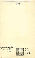
Ottawa Mining Company
|
| Mine Name:
|
Ottawa Mine
|
| Start Date:
|
1934
|
End Date:
|
1939
|
| Type of Mine:
|
Surface
|
| Total acres shown:
|
28
|
| Acres after map date:
|
|
General Area of mining acres shown:
|
|
|
Production indicates approximately 10 acres were mined. The area mined is smaller than shown on the accompanying map.
|
Shaft, Slope, Drift or Tipple Location(s)
| Type
|
County
|
Township-Range
|
Section
|
Part Section
|
| Pit
|
La Salle
|
33N 3E
|
1
|
SE NW
|
Geology
| Colchester
|
22
|
|
|
2.0
|
Surface
|
Geological Problems Reported
Production
| Company
|
Mine Name
|
Date
|
Production (tons)
|
Production Notes
Coal Report production (if available)
Sources of Data
| ISGS map library, 4103.L32 i5.1-9
|
1946
|
1:62500
|
1:62500
|
Secondary source
|
Annotated Bibliography (Data source - brief description of information)
| Coal Reports - Production, ownership, years of operation.
|
| Directory of Illinois Coal Mines (La Salle County) - Mine names, mine index, ownership, years of operation.
|
| Mine notes (La Salle County) - Mine type, mine location, seam, depth, thickness.
|
| ISGS map library, 4103.L32 i5.1-9, USDA Strip Mine Reconnaissance Map - Mine outline, mining method.
|
Mine Notes
Mine Images
Photographs