Mine Index Number: 2694
| Company Name:
|
Alexander McLean Coal Company
|
| Mine Name:
|
McLean Mine
|
| Start Date:
|
1927
|
End Date:
|
1937
|
| Type of Mine:
|
Surface
|
| Total acres shown:
|
None
|
| Acres after map date:
|
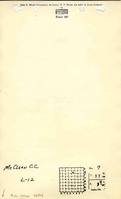
4Three locations were listed in the mine database for McLean’s surface mining, none of which are verified by a company map. The location shown below is the only one reported in the Coal Section’s mine notes. Some of this acreage may have been mined in the Porter Mine (mine index 2693) in SE SW 5- T33N-R4E, one of the locations formerly listed in the mine database.
|
General Area of mining acres shown:
|
|
|
|
Shaft, Slope, Drift or Tipple Location(s)
| Type
|
County
|
Township-Range
|
Section
|
Part Section
|
| Pit
|
La Salle
|
33N 4E
|
7
|
N 1/2
|
Geology
| Colchester
|
15
|
|
|
2.0
|
Surface
|
Geological Problems Reported
Production
| Company
|
Mine Name
|
Date
|
Production (tons)
|
Production Notes
Coal Report production (if available)
Sources of Data
| Mine notes
|
Undated
|
(text only)
|
1:24000The mine location was plotted on a 1:24000 USGS topographic map from the mine location description and digitized.
|
Secondary source
|
Annotated Bibliography (Data source - brief description of information)
| Coal Reports - Production, ownership, years of operation.
|
| Directory of Illinois Coal Mines (La Salle County) - Mine names, mine index, ownership, years of operation.
|
| Mine notes (La Salle County) - Mine type, mine location, depth, thickness.
|
Mine Notes
Mine Images
Photographs