Mine Index Number: 2702
| Company Name:
|
Unknown
|
| Mine Name:
|
Marseilles Mine
|
| Start Date:
|
Circa 1892
|
End Date:
|
Unknown
|
| Type of Mine:
|
Underground
|
| Total acres shown:
|
None
|
| Acres after map date:
|
|
General Area of mining acres shown:
|
|
|
|
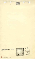
Shaft, Slope, Drift or Tipple Location(s)
| Type
|
County
|
Township-Range
|
Section
|
Part Section
|
| Shaft
|
La Salle
|
33N 5E
|
17
|
SE SE SW
|
Geology
| Colchester
|
100
|
|
|
2.7
|
Underground
|
Geological Problems Reported
The coal was underlain by 9 feet of fire clay.
Production
| Company
|
Mine Name
|
Date
|
Production (tons)
|
| Unknown
|
MarseillesThe mine is included in the 1892 Atlas on Elvin J. Ward’s land. Ward may have operated the mine, or the mine may have been leased by another. R. F. Harrington (mine index 5750), and Carney Brothers (mine index 5747) both operated in 1892 and the locations of these mines are unknown (see the unlocated mines in La Salle County). The shaft location is near the 1892 corporate boundary and is referred to as Marseilles Mine, but the operating name and company and the years of operation are unknown. The mine may have been abandoned when the shaft was noted in the ISGS field notes by G. H. Cady and L. W. Currier in their July 1917 ISGS field notes and was probably abandoned when visited by Currier again in 1922.
|
circa 1892
|
Unknown
|
|
|
Production Notes
Coal Report production (if available)
Sources of Data
| Atlas of La Salle County
|
1892
|
1:31680
|
1:39600
|
Secondary source
|
Annotated Bibliography (Data source - brief description of information)
| Coal Reports - Production, ownership, years of operation.
|
| Directory of Illinois Coal Mines (La Salle County) - Mine names, mine index, ownership, years of operation.
|
| ISGS field notes (La Salle County) - Shaft location, mine type, depth, thickness, geologic problems.
|
| Atlas of La Salle County, published by Alden, Ogle & Co., 1892 - Shaft location.
|
Mine Notes
Mine Images
Photographs