Mine Index Number: 2704
| Company Name:
|
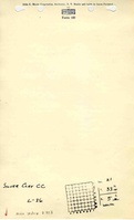
Silver Clay and Coal Company
|
| Mine Name:
|
Silver Mine
|
| Start Date:
|
1906
|
End Date:
|
1937
|
| Type of Mine:
|
Underground
|
| Total acres shown:
|
12
|
| Production Indicated Acres:
|
less than 1
|
General Area of mining acres shown:
|
|
|
|
Shaft, Slope, Drift or Tipple Location(s)
| Type
|
County
|
Township-Range
|
Section
|
Part Section
|
| Main shaft
|
La Salle
|
33N 5E
|
21
|
NW SE NW
|
| Air shaft
|
La Salle
|
33N 5E
|
21
|
NW SE NW
|
| SlopeA cross section of a slope is shown on the 1938 source map, but not the location of the slope on the ground surface. The slope is not shown on the accompanying map, but it is east of the air shaft.
|
La Salle
|
33N 5E
|
21
|
NW SE NW
|
Geology
| Colchester
|
85-100
|
|
|
2.67-2.83
|
RP,LWThe Coal Reports indicated that room and pillar mining took place from 1909 to 1911. Longwall mining was reported for all other years. All mining from 1918 to 1937 was room and pillar mining, and clay was mined along with the coal. (old longwall)
|
Geological Problems Reported
A few slips were noted in the coal with a displacement of about 6 inches. The underclay was 6 feet to 15 feet thick and was mined along with the coal.
Production
| Company
|
Mine Name
|
Date
|
Production (tons)
|
| Chicago Fire Brick Company
|
Chicago Fire Brick
|
1918-1921Bulletin 38 states on page 391, “The Chicago Firebrick Company is reopening Company’s mine 2 miles east of Marseilles with the intention of obtaining the clay feet. The clay is worked from a new face at the outer margin of the former mine by the room † Production after map date.
|
6,422
|
|
|
Production Notes
Coal Report production (if available)
Sources of Data
| Microfilm, document 352418
|
9-19-1921
|
1:1200
|
1:2566
|
Not finalThe map is final for the longwall mining in the main body of the mine and not final for the room & pillar mining in the northern part of the mine.
|
| Microfilm, document 352427
|
1-5-1938
|
1:1200
|
1:993
|
Final
|
Annotated Bibliography (Data source - brief description of information)
| Coal Reports - Production, ownership, years of operation, depth, thickness, mining method.
|
| Mine notes (La Salle County) - Mine type, shaft location, seam, depth, thickness.
|
| Microfilm map, document 352418, reel 03139, frame 90 - Shaft locations, mine outline, mining methods.
|
| Microfilm map, document 352427, reel 03139, frame 101 - Shaft locations, mine outline (SE part), mining methods.
|
| ISGS field notes (La Salle County) - Depth, thickness, geologic problems.
|
| DeWolf, F. W, et al., 1922, Year Book for 1917 and 1918, ISGS Bulletin 38 - Ownership.
|
Mine Notes
Mine Images
Photographs