Mine Index Number: 2796
| Company Name:
|
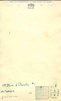
Mt. Olive and Staunton Coal Company
|
| Mine Name:
|
Mt. Olive and Staunton No. 1 Mine
|
| Start Date:
|
1897
|
End Date:
|
1923
|
| Type of Mine:
|
Underground
|
| Total acres shown:
|
1,036
|
| Acres after map date:
|
|
General Area of mining acres shown:
|
|
|
|
Shaft, Slope, Drift or Tipple Location(s)
| Type
|
County
|
Township-Range
|
Section
|
Part Section
|
| Main shaft (8'x16')
|
Madison
|
6N 6W
|
8
|
NE NE NW
|
| Air shaft
|
Madison
|
6N 6W
|
8
|
NE NE NW
|
Geology
| Herrin
|
292
|
4.0
|
7.0
|
5.2-6.1
|
MRP
|
Geological Problems Reported
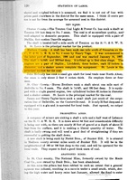
Displacements (slips and faults) were very slight, and the coal was never cut out.
Production
| Company
|
Mine Name
|
Date
|
Production (tons)
|
|
|
|
|
|
| Total Production: 6,062,095
|
Production Notes
Coal Report production (if available)
Sources of Data
| State archive, IL_1665_01
|
4-1-1923
|
1:2400
|
1:2400
|
Not final
|
| State archive, IL_94_01
|
10-1912
|
1:2400
|
1:2400
|
Not final
|
| State archive, IL_1731_03
|
11-13-1905
|
1:2400
|
1:2400
|
Not final
|
| State archive, IL_2646
|
Undated
|
1:2400
|
1:24000
|
Undated
|
| State archive, IL_44
|
3-13-1928
|
1:2400
|
1:2400
|
Secondary source
|
Annotated Bibliography (Data source - brief description of information)
| Coal Reports - Production, ownership, years of operation, depth.
|
| Directory of Illinois Coal Mines (Madison County) - Mine names, mine index, ownership, years of operation.
|
| Mine notes (Madison County) - Mine type, shaft location, seam, thickness, geologic problems.
|
| State archive, IL_1665_01 - Shaft locations, mine outline, mining method.
|
| State archive, IL_94_01 - Mine outline (additional mining on north side of mine).
|
| State archive, IL_1731_03 - Mine outline (additional mining on west side of mine).
|
| State archive, IL_2646, map of Mt. Olive and Staunton No. 2 Mine (mine index 73) - Mine outline (additional mining on east and northeast sides of mine).
|
| State archive, IL_44, map of Livingston and Mt. Olive No. 1 Mine (mine index 72) - Mine outline (additional mining on south side of mine).
|
Mine Notes
Mine Images
Photographs
![[[:Mt. Olive and Staunton No. 1|Mt. Olive and Staunton No. 1]]](https://go.illinois.edu/ILMImages/madison/thumbnails/m2796_IL_94_01_th.jpg)
![[[:Mt. Olive and Staunton No. 1|Mt. Olive and Staunton No. 1]]](https://go.illinois.edu/ILMImages/madison/thumbnails/m2796_IL_1731_03_th.jpg)
![[[:Mt. Olive and Staunton No. 1|Mt. Olive and Staunton No. 1]]](https://go.illinois.edu/ILMImages/madison/thumbnails/m2796_IL_1665_01_th.jpg)
![[[:Mt. Olive and Staunton No. 2|Mt. Olive and Staunton No. 2]]](https://go.illinois.edu/ILMImages/madison/thumbnails/m0073_IL_2646_th.jpg)
![[[:New Staunton No. 1|New Staunton No. 1]]](https://go.illinois.edu/ILMImages/madison/thumbnails/m0072_IL_44_th.jpg)