Mine Index Number: 2915
| Company Name:
|
Carlinville Coal Mining Company
|
| Mine Name:
|
South Mine
|
| Start Date:
|
1918
|
End Date:
|
March 1953
|
| Type of Mine:
|
Underground
|
| Total acres shown:
|
187
|
| Acres after map date:
|
2
|
General Area of mining acres shown:
|
|
|
|
Shaft, Slope, Drift or Tipple Location(s)
| Type
|
County
|
Township-Range
|
Section
|
Part Section
|
| Main shaft (7.5 x 15.67 ft)
|
Macoupin
|
10N 7W
|
33
|
SE NW SW
|
| Air shaft (3 x 7.5 ft)
|
Macoupin
|
10N 7W
|
33
|
SE NW SW
|
Geology
| Herrin
|
250-265
|
|
|
5.42-6.0
|
RPP
|
Geological Problems Reported
Concretions were present in the black shale roof. In other areas, a light gray shale called clod made up the roof. When exposed to stagnant air, the clod swelled up and broke away from the limestone caprock. In this process, heat was generated, and fire in the old works sometimes resulted. In one case, it fired a high rider coal some 20 feet above the top of the Herrin Coal. The clod had a large number of slips, which contributed to instability, with large chunks falling and leaving holes in the roof.
Production
| Company
|
Mine Name
|
Date
|
Production (tons)
|
|
|
|
|
|
| Total Production: 826,162
|
Production Notes
Coal Report production (if available)
Sources of Data
| Company, 4103.M34 i5.1-50
|
1-2-1952
|
1:2400
|
1:2400
|
Not final
|
Annotated Bibliography (Data source - brief description of information)
| Coal Reports - Production, ownership, years of operation.
|
| Directory of Illinois Coal Mines (Macoupin County) - Mine names, mine index, ownership, years of operation.
|
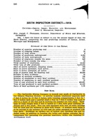
| Mine notes (Macoupin County) - Mine type, shaft location, seam, depth, thickness.
|
| Company map, ISGS map library, 4103.M34 i5.1-50 - Shaft locations, mine outline, mining method.
|
Mine Notes
Mine Images
![[[:South|South]]](https://go.illinois.edu/ILMImages/macoupin/thumbnails/m2915_th.jpg) These files may not be true to scale and are not georgistered. These files may not be true to scale and are not georgistered.
|
Map Type:
|
Company
|
| Map ID:
|
4103.M34 i5.1-50
|
| Company:
|
Carlinville Coal Mining Company
|
| Mine Name:
|
South
|
| Caption:
|
|
| Map Date:
|
01-02-1952
|
| Map Status:
|
Not Final
|
| Image Credit:
|
|
| Note:
|
|
| More Info:
|
M2915
|
| Full Res Download:These files are true to scale and most are georegistered for gis software. These files may be a very large (>1GB) download!
|
https://go.illinois.edu/ILMImages/macoupin/m2915.zip
|
Photographs


![[[:South|South]]](https://go.illinois.edu/ILMImages/macoupin/thumbnails/m2915_th.jpg)