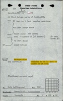
Mine Index Number: 2937
| Company Name:
|
L. Mustard
|
| Mine Name:
|
Mustard Mine
|
| Start Date:
|
Circa 1918
|
End Date:
|
Unknown
|
| Type of Mine:
|
Underground
|
| Total acres shown:
|
None
|
| Acres after map date:
|
|
General Area of mining acres shown:
|
|
|
|
Shaft, Slope, Drift or Tipple Location(s)
| Type
|
County
|
Township-Range
|
Section
|
Part Section
|
| Main shaft
|
Macoupin
|
12N 9W
|
4
|
SE NW NE
|
Geology
| Herrin
|
39-45
|
|
|
2.67
|
Underground
|
Geological Problems Reported
Production
| Company
|
Mine Name
|
Date
|
Production (tons)
|
| L. Mustard The mine notes indicate that this mine operated 1918, but it was not listed under this name in the Coal Reports. Production and years of operation are unknown.
|
Mustard
|
circa 1918
|
Unknown
|
|
|
Production Notes
Coal Report production (if available)
Sources of Data
| Jacksonville (15') Quadrangle
|
1937
|
1:62500
|
1:62500
|
Secondary source
|
| ISGS map library, 4103.M34 i5.1-27
|
3-20-1934
|
1:62500
|
1:62500
|
Secondary source
|
Annotated Bibliography (Data source - brief description of information)
| Directory of Illinois Coal Mines (Macoupin County) - Mine names, mine index, ownership, years of operation.
|
| Mine notes (Macoupin County) - Mine name, mine type, seam, depth, thickness, general mine location.
|
| USGS topographic map, Jacksonville (15') Quadrangle - Shaft location.
|
| ISGS map library, 4103.M34 i5.1-27, work map for Federal Land Bank Report - General area of mining.
|
Mine Notes
Mine Images
 These files may not be true to scale and are not georgistered. These files may not be true to scale and are not georgistered.
|
Map Type:
|
ISGS map library
|
| Map ID:
|
4103.M34 i5.1-27
|
| Company:
|
|
| Mine Name:
|
|
| Caption:
|
|
| Map Date:
|
3-20-1934
|
| Map Status:
|
Secondary
|
| Image Credit:
|
|
| Note:
|
Work map for Macoupin County Federal Land Bank Report
|
| More Info:
|
Maplib quade1 geo
|
| Full Res Download:These files are true to scale and most are georegistered for gis software. These files may be a very large (>1GB) download!
|
https://go.illinois.edu/ILMImages/macoupin/maplib quade1 geo.zip
|
 These files may not be true to scale and are not georgistered. These files may not be true to scale and are not georgistered.
|
Map Type:
|
USGS topographic
|
| Map ID:
|
USGS topographic Coal Section files
|
| Company:
|
|
| Mine Name:
|
|
| Caption:
|
|
| Map Date:
|
1937
|
| Map Status:
|
Secondary
|
| Image Credit:
|
|
| Note:
|
|
| More Info:
|
M2937 geo
|
| Full Res Download:These files are true to scale and most are georegistered for gis software. These files may be a very large (>1GB) download!
|
https://go.illinois.edu/ILMImages/macoupin/m2937 geo.zip
|
Photographs