Mine Index Number: 3184
| Company Name:
|
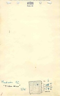
Madison Coal Corporation
|
| Mine Name:
|
Tilden Mine
|
| Start Date:
|
1887
|
End Date:
|
March 1919
|
| Type of Mine:
|
Underground
|
| Total acres shown:
|
755 The area shown on the accompanying map for the Tilden Mine could not be separated from the Crystal Mine (mine index 0208). The area shown is for both mines.
|
| Acres after map date:
|
|
General Area of mining acres shown:
|
|
|
|
Shaft, Slope, Drift or Tipple Location(s)
| Type
|
County
|
Township-Range
|
Section
|
Part Section
|
| Main shaft
|
Randolph
|
4S 5W
|
6
|
NE SW NE
|
| Air shaft
|
Randolph
|
4S 5W
|
6
|
NE SW NE
|
Geology
Geological Problems Reported
Production
| Company
|
Mine Name
|
Date
|
Production (tons)
|
|
|
|
|
|
| Total Production: 1,073,692
|
Production Notes
Coal Report production (if available)
Sources of Data
| Company
|
1931
|
1:2400
|
1:2400
|
Final
|
Annotated Bibliography (Data source - brief description of information)
| Coal Reports - Production, ownership, years of operation, thickness.
|
| Directory of Illinois Coal Mines (Randolph County) - Mine names, mine index, ownership, years of operation.
|
| Mine notes (Randolph County) - Mine type, shaft location, seam, depth.
|
| Company map, Old Ben Collection - Shaft locations, mine outline, mining method.
|
Mine Notes
Mine Images
![[[:Crystal|Crystal]], [[:Tilden|Tilden]]](https://wikiimage.isgs.illinois.edu/ilmines/randolph/thumbnails/m0208a.jpg) These files may not be true to scale and are not georgistered. These files may not be true to scale and are not georgistered.
|
Map Type:
|
Company
|
| Map ID:
|
|
| Company:
|
Great Western Coal Company
|
| Mine Name:
|
Crystal, Tilden
|
| Caption:
|
|
| Map Date:
|
1931
|
| Map Status:
|
Final
|
| Image Credit:
|
|
| Note:
|
|
| More Info:
|
M0208a.tif
|
| Full Res Download:These files are true to scale and most are georegistered for gis software. These files may be a very large (>1GB) download!
|
https://wikiimage.isgs.illinois.edu/ilmines/randolph/m0208a.zip
|
Photographs