Mine Index Number: 3189
| Company Name:
|
John Fellers
|
| Mine Name:
|
Fellers Mine
|
| Start Date:
|
1881
|
End Date:
|
1882
|
| Type of Mine:
|
Underground
|
| Total acres shown:
|
|
| Acres after map date:
|
|
General Area of mining acres shown:
|
10
|
|
|
Shaft, Slope, Drift or Tipple Location(s)
| Type
|
County
|
Township-Range
|
Section
|
Part Section
|
| Main shaft
|
Randolph
|
4S 6W
|
34
|
NE NE SW
|
Geology
| Herrin
|
90
|
1.5
|
6.5
|
2.0
|
Underground
|
Geological Problems Reported
Production
| Company
|
Mine Name
|
Date
|
Production (tons)
|
| John Fellers
|
Fellers
|
1881-1882
|
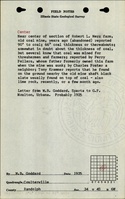
Not reported The 1882 Coal Report listed the coal property as 160 acres, but did not report how many acres had been worked out. Fellers may have begun operations and ceased without a listed production, or the mine may have been idled and then abandoned in 1882. Field notes from 1925 indicated that coal was supplied to farmers & threshermen, as reported by Perry Fellers, whose father owned the farm when the mine was sunk.
|
|
|
Production Notes
Coal Report production (if available)
Sources of Data
| Federal Land Bank Report
|
July 1934
|
1:126720
|
1:126720
|
Secondary source
|
Annotated Bibliography (Data source - brief description of information)
| Coal Reports - Production, ownership, years of operation, mine type.
|
| Directory of Illinois Coal Mines (Randolph County) - Mine names, mine index, ownership, years of operation.
|
| Mine notes (Randolph County) - Shaft location, depth, thickness.
|
| ISGS field notes (Randolph County) - Ownership, depth, thickness.
|
| Federal Land Bank Report (Randolph County) - Shaft location, mine outline, mining method.
|
Mine Notes
Mine Images
Photographs