Mine Index Number: 3494
| Company Name:
|
Unknown
|
| Mine Name:
|
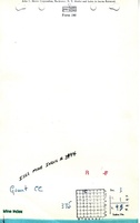
Grant Mine
|
| Start Date:
|
Unknown
|
End Date:
|
Unknown
|
| Type of Mine:
|
Underground
|
| Total acres shown:
|
None
|
| Acres after map date:
|
|
General Area of mining acres shown:
|
|
|
|
Shaft, Slope, Drift or Tipple Location(s)
| Type
|
County
|
Township-Range
|
Section
|
Part Section
|
| Main drift
|
St. Clair
|
1N 9W
|
3
|
NW NE NW
|
Geology
| Springfield
|
32
|
|
|
3.0
|
Underground
|
Geological Problems Reported
Production
| Company
|
Mine Name
|
Date
|
Production (tons)
|
| Unknown
|
Grant
|
Unknown Production and years operated at this location are unknown.
|
Unknown Production and years operated at this location are unknown.
|
| Total Production: Unknown Production and years operated at this location are unknown.
|
Production Notes
Coal Report production (if available)
Sources of Data
| Mine notes
|
Undated
|
1:62500
|
1:62500
|
Secondary source
|
Annotated Bibliography (Data source - brief description of information)
| Directory of Illinois Coal Mines (St. Clair County) - Mine names, mine index, ownership, years of operation.
|
| Mine notes (St. Clair County) - Thickness, depth, seams, mine type, drift location, mine name.
|
Mine Notes
Mine Images
Photographs