Mine Index Number: 3515
| Company Name:
|
Northwestern Coal Company
|
| Mine Name:
|
Northwestern Mine
|
| Start Date:
|
Pre 1874
|
End Date:
|
1892
|
| Type of Mine:
|
Underground
|
| Total acres shown:
|
516
|
| Acres after map date:
|
|
General Area of mining acres shown:
|
|
|
The source map for the Consolidated Coal Company of St. Louis mines in this area is very poor, and the boundaries between the separate mines could not be distinguished. The acreage reported is the total for mine index numbers 3513, 3515, 3517 and 3518.
|
Shaft, Slope, Drift or Tipple Location(s)
| Type
|
County
|
Township-Range
|
Section
|
Part Section
|
| Main shaft
|
St. Clair
|
1N 8W
|
16
|
SW NW NW
|
Geology
| Herrin
|
100-185
|
|
|
6.0-7.0
|
RPB
|
Geological Problems Reported
Production
| Company
|
Mine Name
|
Date
|
Production (tons)
|
|
|
|
|
|
| Total Production: 133,466
|
Production Notes
Coal Report production (if available)
Sources of Data
| Microfilm, document 350961
|
3-30-1910
|
1:2400
|
1:5297
|
Final
|
| Atlas of St. Clair County
|
1874
|
1:36205
|
1:36205
|
Secondary source
|
Annotated Bibliography (Data source - brief description of information)
| Coal Reports - Production, ownership, years of operation, seam, depth, thickness, mine type.
|
| Directory of Illinois Coal Mines (St. Clair County) - Mine names, mine index, ownership, years of operation.
|
| Microfilm map, document 350961, reel 03134, frame 4 - Shaft locations, mine outline, mining method.
|
| Atlas of St. Clair County, Illinois, 1874, Warner & Beers, Chicago, Illinois - Shaft location, years of operation.
|
Mine Notes
Mine Images
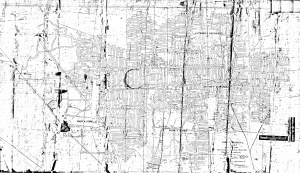
Microfilm: 350961
Map Date: 3-30-1910
Coal Co.: Consolidated Coal Company of St. Louis
Mine Name: Green Mount Mine
Full Res Download
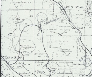
Atlas: T1N-R8W
Map Date: 1874
Coal Co.: William Skellett
Mine Name: Skellett Mine
Full Res Download
Photographs


