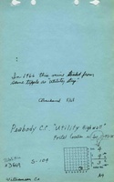
Mine Index Number: 3669
| Company Name:
|
Peabody Coal Company
|
| Mine Name:
|
Utility Highwall Mine
|
| Start Date:
|
1965
|
End Date:
|
August 1968
|
| Type of Mine:
|
Underground
|
| Total acres shown:
|
245
|
| Acres after map date:
|
|
General Area of mining acres shown:
|
|
|
|
Shaft, Slope, Drift or Tipple Location(s)
| Type
|
County
|
Township-Range
|
Section
|
Part Section
|
| Main drift
|
Williamson
|
9S 3E
|
11
|
NW NE SW
|
| Air drift
|
Williamson
|
9S 3E
|
11
|
NW NE SW
|
| Air shaft
|
Williamson
|
9S 3E
|
11
|
NE NW SW
|
Geology
| Herrin
|
60-90
|
|
|
5.67-6.17
|
RPP
|
Geological Problems Reported
Production
| Company
|
Mine Name
|
Date
|
Production (tons)
|
Production Notes
Coal Report production (if available)
Sources of Data
| State archive, MSHA_492_01
|
8-7-1968
|
1:2400
|
1:2400
|
Final
|
Annotated Bibliography (Data source - brief description of information)
| Coal Reports - Production, ownership, years of operation, seam depth, thickness.
|
| Directory of Illinois Coal Mines (Williamson County) - Mine names, mine index, ownership, years of operation.
|
| Mine notes (Williamson County) - Mine type, drift location.
|
| State archive, MSHA_492_01 - Drift and shaft locations, mine outline, mining method.
|
Mine Notes
Mine Images
Photographs
![[[:Utility Highwall|Utility Highwall]]](https://wikiimage.isgs.illinois.edu/ilmines/williamson/thumbnails/m3669_msha_492_01_geo_th.jpg)