Mine Index Number: 4209
| Company Name:
|
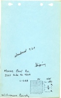
Morse Coal Company
|
| Mine Name:
|
Morse Mine
|
| Start Date:
|
1964
|
End Date:
|
September 1964
|
| Type of Mine:
|
Surface
|
| Total acres shown:
|
5
|
| Production Indicated Acres:
|
3
|
General Area of mining acres shown:
|
|
|
|
Shaft, Slope, Drift or Tipple Location(s)
| Type
|
County
|
Township-Range
|
Section
|
Part Section
|
| Tipple / pit
|
Williamson
|
9S 4E
|
36
|
NW
|
Geology
Geological Problems Reported
Production
| Company
|
Mine Name
|
Date
|
Production (tons)
|
| George Turner
|
Turner
|
1966-1966
|
not reported Re-opened, then again abandoned in March 1966; production (if any) not reported
|
|
|
Production Notes
Coal Report production (if available)
Sources of Data
| Coal Section files, 7a-02-12
|
1965
|
1:8123
|
1:8123
|
Secondary source
|
Annotated Bibliography (Data source - brief description of information)
| Coal Reports - Production, ownership, years of operation, seam depth, thickness, mining method.
|
| Directory of Illinois Coal Mines (Williamson County) - Mine names, mine index, ownership, years of operation.
|
| Mine notes (Williamson County) - Mine type, pit location.
|
| Coal Section files, 7a-02-12, DMM surface mine updates on 1960 aerial photo base map - Mine outline.
|
Mine Notes
Mine Images
Photographs