Mine Index Number: 6648
| Company Name:
|
Illinois Zinc Company
|
| Mine Name:
|
Black Hollow Mine
|
| Start Date:
|
Circa 1926
|
End Date:
|
Unknown
|
| Type of Mine:
|
Underground
|
| Total acres shown:
|
None(see Deer Park Mine, mine index 9)
|
| Acres after map date:
|
|
General Area of mining acres shown:
|
|
|
|
Shaft, Slope, Drift or Tipple Location(s)
| Type
|
County
|
Township-Range
|
Section
|
Part Section
|
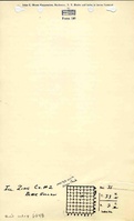
| Main shaft
|
La Salle
|
33N 2E
|
31
|
SE SW NE
|
| Air shaft
|
La Salle
|
33N 2E
|
30
|
SE SW NECoal production for this mine and the Deer Park Mine (mine index 9) was reported beginning 1900, but these shaft locations were shown on the 1876 Atlas of La Salle County under the ownership of the M. Reynolds Estate. They are labeled “Coal Banks”, and were not only clay mines.
|
| Old air shaft
|
La Salle
|
33N 2E
|
30
|
SE SW NECoal production for this mine and the Deer Park Mine (mine index 9) was reported beginning 1900, but these shaft locations were shown on the 1876 Atlas of La Salle County under the ownership of the M. Reynolds Estate. They are labeled “Coal Banks”, and were not only clay mines.
|
Geology
| Colchester
|
|
|
|
|
LW (old longwall)
|
Geological Problems Reported
Production
| Company
|
Mine Name
|
Date
|
Production (tons)
|
| Illinois Zinc Company
|
Black HollowThis mine may be Illinois Zinc No. 2, since the location of Illinois Zinc No. 1 and No. 3 are known.
|
circa 1926
|
unknownProduction was probably reported under Deer Park Mine (also known as Illinois Zinc No. 1 Mine, mine index 9). The mine notes indicate these two mines merged, and the source map shows that separate boundaries between the two mines can not be discerned.
|
|
|
Production Notes
Coal Report production (if available)
Sources of Data
| Microfilm, document 352412
|
Undated
|
1:1200
|
1:2482
|
Undated
|
Annotated Bibliography (Data source - brief description of information)
| Directory of Illinois Coal Mines (La Salle County) - Mine names, mine index, ownership, years of operation.
|
| Mine notes (La Salle County) - Mine location, mine name.
|
| Microfilm map, document 352412, reel 03139, frames 80 and 81 - Slope and shaft locations, mine outline, mining method.
|
| Warner and Beers, 1876, Atlas of La Salle County, Illinois, Chicago, Illinois – Presence of air shaft and old air shaft.
|
Mine Notes
Mine Images
Photographs