Mine Index Number: 7883
| Company Name:
|
Unknown
|
| Mine Name:
|
Unknown Mine
|
| Start Date:
|
Before 1928
|
End Date:
|
Unknown
|
| Type of Mine:
|
Underground
|
| Total acres shown:
|
None
|
| Acres after map date:
|
No mining took place, so no additional acreage was mined out.
|
General Area of mining acres shown:
|
|
|
|
Shaft, Slope, Drift or Tipple Location(s)
| Type
|
County
|
Township-Range
|
Section
|
Part Section
|
| Main shaft
|
Greene
|
12N 10W
|
7
|
NE SE NE
|
Geology
Geological Problems Reported
Production
| Company
|
Mine Name
|
Date
|
Production (tons)
|
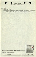
| Unknown The shaft was constructed, but according to people near the shaft, no coal was produced. The shaft was abandoned and considered old when Stott visited in 1928.
|
|
before 1928
|
|
|
|
Production Notes
Coal Report production (if available)
Sources of Data
| ISGS field notes (K. W. Stott)
|
7-23-1928
|
1:62500
|
1:62500
|
Secondary source
|
Annotated Bibliography (Data source - brief description of information)
| Directory of Illinois Coal Mines (Greene County) - Mine names, mine index, ownership, years of operation.
|
| ISGS field notes (Greene County) - Mine type, shaft location.
|
Mine Notes
Mine Images
Photographs