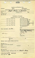
Mine Index Number: 90995665
| Company Name:
|
Ray Coal Company
|
| Mine Name:
|
Ray Mine
|
| Start Date:
|
1939
|
End Date:
|
1941
|
| Type of Mine:
|
Underground
|
| Total acres shown:
|
|
| Production Indicated Acres:
|
Less than 1
|
General Area of mining acres shown:
|
|
| This Mine is unlocated and does not appear on the map.
|
Shaft, Slope, Drift or Tipple Location(s)
| Type
|
County
|
Township-Range
|
Section
|
Part Section
|
Geology
| Danville
|
69
|
|
|
4.75
|
Underground
|
Geological Problems Reported
Production
| Company
|
Mine Name
|
Date
|
Production (tons)
|
Production Notes
Coal Report production (if available)
Sources of Data
Annotated Bibliography (Data source - brief description of information)
| Coal Report - Mine ownership, years of operation, production.
|
| Mine notes (La Salle County) - Mine type, seam, depth, thickness.
|
Mine Notes
Mine Images
Photographs