Canton Quadrangle
Mining in the Canton Quadrangle
The earliest mine in the Canton vicinity was Ezra Fairchild’s drift mine in the Canton Township (T7N-R4E). The location of that mine is not known, merely that the mine was near a mill that was active at the time. The Piper Mine (mine index 6616), 1.5 miles north of Canton on the east bank of Big Creek, was active in 1859.
In the northern part of the Canton Quadrangle, both the Herrin and Springfield Coals were mined, and were accessed by surface and underground mines. In the southern part of the Canton Quadrangle, the Springfield Coal was the only seam available economically (although the Colchester Coal is present). The Springfield Coal cropped out along Big Creek and its tributaries, so the coal was entered into via drift and slope entries, but shaft mines were common as well. Because the coal was shallow, roof difficulties were common, as were the normal problems of the Springfield Coal, such as horsebacks and concretions in the shale above the coal. The most recent mine, Buckheart No. 17 Mine (mine index 705), closed in 1984.
Map and Directory PDF Download
Coal Mines In Illinois Canton Quadrangle
Mines that Appear on the Canton Quadrangle
Unlocated Mines
Fulton County
Pages in category "Canton Quadrangle"
The following 92 pages are in this category, out of 92 total.
2
5
Media in category "Canton Quadrangle"
The following 5 files are in this category, out of 5 total.
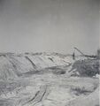 Image 2317.jpg 808 × 859; 190 KB
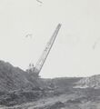 Image 2462.jpg 810 × 886; 155 KB
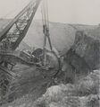 Image 2765.jpg 837 × 893; 227 KB
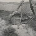 Image 2766.jpg 831 × 856; 217 KB
 Image 2767.jpg 836 × 807; 166 KB


