Gillespie North Quadrangle
Mining in the Gillespie North Quadrangle
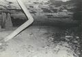
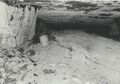
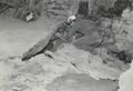
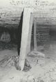
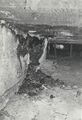
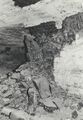
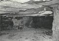
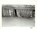
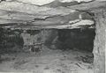
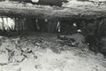
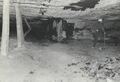
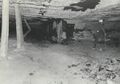
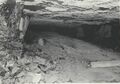
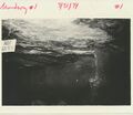
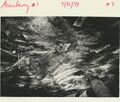
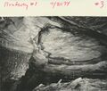
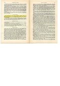
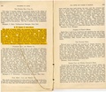
The eastern two-thirds of the Gillespie North Quadrangle is within an area known as the Hornsby District, known for thick, low-sulfur coal (Nelson, 1987). The mines in this area have an Energy Shale roof, an overbank deposit from the Walshville channel further east that reaches thicknesses of over 60 feet. The Energy Shale that forms the immediate roof in this area has lower physical strength and slake (moisture) durability than similar shales in southern Illinois. The older mines in the Gillespie North Quadrangle are smaller and generally had shorter operating lifespan than the mines directly south, most likely as a result of problems encountered in supporting the roof and keeping the entries clear of roof fall material. The Gillespie Mine (mine index 763) left 12 to 18 inches of coal to help support the roof. This also protected the Energy Shale roof from changes in humidity, which caused greater instability. The coal here is thick, ranging up to 9 feet. The minimum reported thickness was 6 feet, and most average thicknesses were 7 feet or more. The mines were between 300 and 400 feet deep.
Map and Directory PDF Download
Coal Mines In Illinois Gillespie North Quadrangle
Mines that Appear on the Gillespie North Quadrangle
Unlocated Mines
Macoupin County
Pages in category "Gillespie North Quadrangle"
The following 21 pages are in this category, out of 21 total.
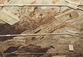
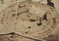
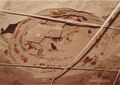
Media in category "Gillespie North Quadrangle"
The following 47 files are in this category, out of 47 total.
 M0066 coalreport1905.pdf 633 × 977; 101 KB
 M0066 coalreport1906.pdf 1,679 × 1,283; 382 KB
 M0066 minenotes.pdf 731 × 1,202, 39 pages; 18.29 MB
 M0413 coalreport1903.pdf 1,552 × 1,239; 308 KB
 M0413 coalreport1904.pdf 1,641 × 1,227, 2 pages; 879 KB
 M0413 minenotes.pdf 731 × 1,202, 28 pages; 12.74 MB
 M0763 coalreport1884.pdf 1,520 × 1,320; 355 KB
 M0763 coalreport1885.pdf 1,275 × 1,650; 304 KB
 M0763 coalreport1897.pdf 839 × 1,185, 4 pages; 814 KB
 M0763 minenotes.pdf 731 × 1,202, 11 pages; 2.84 MB
 M0843 minenotes.pdf 731 × 1,202, 27 pages; 7.55 MB
 M0886 minenotes 01.jpg 667 × 461; 48 KB
 M0886 minenotes 02.jpg 967 × 675; 118 KB
 M0886 minenotes 03.jpg 668 × 462; 68 KB
 M0886 minenotes 04.jpg 668 × 466; 73 KB
 M0886 minenotes 05.jpg 667 × 458; 69 KB
 M0886 minenotes 06.jpg 459 × 670; 61 KB
 M0886 minenotes 07.jpg 457 × 667; 77 KB
 M0886 minenotes 08.jpg 460 × 665; 86 KB
 M0886 minenotes 09.jpg 667 × 460; 78 KB
 M0886 minenotes 10 a.jpg 3,008 × 2,412; 535 KB
 M0886 minenotes 10 b.jpg 666 × 462; 79 KB
 M0886 minenotes 10.jpg 671 × 447; 72 KB
 M0886 minenotes 11.jpg 667 × 458; 63 KB
 M0886 minenotes 12 a.jpg 660 × 461; 63 KB
 M0886 minenotes 12.jpg 665 × 466; 77 KB
 M0886 minenotes 13.jpg 697 × 603; 66 KB
 M0886 minenotes 14.jpg 681 × 579; 94 KB
 M0886 minenotes 15.jpg 664 × 566; 88 KB
 M0886 minenotes 16.jpg 680 × 553; 98 KB
 M0886 minenotes 17.jpg 675 × 559; 95 KB
 M0886 minenotes 18.jpg 740 × 523; 97 KB
 M0886 minenotes 19.jpg 747 × 528; 74 KB
 M0886 minenotes 19b.jpg 3,001 × 2,065; 554 KB
 M0886 minenotes 20 b.jpg 2,986 × 2,064; 486 KB
 M0886 minenotes 20.jpg 736 × 523; 78 KB
 M0886 minenotes.pdf 745 × 1,266, 108 pages; 47.53 MB
 M2906 fieldnotes.pdf 750 × 1,187; 204 KB
 M2906 minenotes.pdf 731 × 1,202, 4 pages; 866 KB
 M2907 coalreport1884.pdf 1,520 × 1,320; 355 KB
 M2907 coalreport1885.pdf 1,652 × 1,293; 818 KB
 M2907 coalreport1906.pdf 1,662 × 1,277; 432 KB
 M2907 minenotes.pdf 731 × 1,202, 9 pages; 2.38 MB
 M2908 coalreport1884.pdf 1,520 × 1,320; 352 KB
 M2908 coalreport1885.pdf 1,275 × 1,650; 303 KB
 M2908 minenotes.pdf 731 × 1,202, 7 pages; 1.59 MB
 Monterey Mine No 1 and No 2 by Monterey Coal Co 1992.pdf 1,270 × 1,706, 49 pages; 10.87 MB


