Mine Index Number: 0413
| Company Name:
|
Superior Coal Company
|
| Mine Name:
|
Superior No. 1 Mine
|
| Start Date:
|
1904
|
End Date:
|
May 1951
|
| Type of Mine:
|
Underground
|
| Total acres shown:
|
19,186
|
| Acres after map date:
|
|
General Area of mining acres shown:
|
|
|
The boundaries between this mine, Superior No. 2 (mine index 0503), Superior No. 3 (mine index 0066), and Superior No. 4 (mine index 0188) could not be distinguished. The acreage reported is the total for all four mines.
|
Shaft, Slope, Drift or Tipple Location(s)
| Type
|
County
|
Township-Range
|
Section
|
Part Section
|
| Main shaft (9 x 17 ft)
|
Macoupin
|
8N 6W
|
29
|
1100 FSL, 1200 FEL, NW
|
| Air shaft
|
Macoupin
|
8N 6W
|
29
|
NW SE NW
|
Geology
| Herrin
|
320-348
|
6.5
|
9.0
|
7.0-7.5
|
RPP
|
Geological Problems Reported
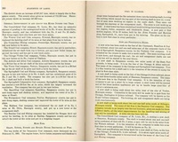
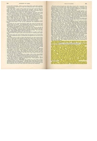
The clay lamina in the upper bench were a detriment as it was next to impossible to pick out much of this material. These upper clay band horizons changed gradually to stony pyrite lenses. There were some facings of pyrite and calcite, of minor importance as an ash constituent. Some gas was present in pockets in the roof shale. Roof rolls were present over the entire mine. A great thickness of soapstone was immediately above the coal. The soapstone was fractured, slipped and very difficult to hold. The coal underneath much of this soapstone was very thinly laminated. Thus, although sometimes left as roof, it served very poorly. The coal was thickest under the thickest areas of soapstone. For instance, where the soapstone was 28 feet thick, the coal was 9 feet thick. A squeeze occurred in the southeast part of the mine. Concretions were common in some parts of the mine.
Production
| Company
|
Mine Name
|
Date
|
Production (tons)
|
Production Notes
Coal Report production (if available)
Sources of Data
| State archive, IL_1126_03
|
undated
|
1:4800
|
1:4800
|
Final
|
| State archive, IL_1130
|
undated
|
1:4800
|
1:4800
|
Final
|
| State archive, IL_1124
|
10-29-1953
|
1:4800
|
1:4800
|
Final
|
| State archive, IL_1102
|
8-7-1953
|
1:4800
|
1:4800
|
Final
|
Annotated Bibliography (Data source - brief description of information)
| Coal Reports - Production, ownership, years of operation, depth.
|
| Directory of Illinois Coal Mines (Macoupin County) - Mine names, mine index, ownership, years of operation.
|
| Mine notes (Macoupin County) - Mine type, shaft location, seam, depth, thickness, geologic problems.
|
| State archive, IL_1126_03 - Shaft locations, mine outline (east, northeast, north central), mining method.
|
| State archive, IL_1130, map of Superior No. 4 (mine index 0188) - Mine outline (west, southwest).
|
| State archive, IL_1124, map of Superior No. 3 (mine index 0066) - Mine outline (west, north).
|
| State archive, IL_1102, map of Superior No. 2 (mine index 0503) - Mine outline (southeast, south central).
|
Mine Notes
Mine Images
![[[:Superior No. 2|Superior No. 2]]](https://go.illinois.edu/ILMImages/macoupin/thumbnails/m0503_IL_1102_th.jpg) These files may not be true to scale and are not georgistered. These files may not be true to scale and are not georgistered.
|
Map Type:
|
State Archive
|
| Map ID:
|
IL_1102
|
| Company:
|
Superior Coal Company
|
| Mine Name:
|
Superior No. 2
|
| Caption:
|
|
| Map Date:
|
08-07-1953
|
| Map Status:
|
Final
|
| Image Credit:
|
|
| Note:
|
|
| More Info:
|
M0503 IL 1102
|
| Full Res Download:These files are true to scale and most are georegistered for gis software. These files may be a very large (>1GB) download!
|
https://go.illinois.edu/ILMImages/macoupin/m0503 IL 1102.zip
|
![[[:Superior No. 1|Superior No. 1]]](https://go.illinois.edu/ILMImages/macoupin/thumbnails/m0413_IL_1126_th.jpg) These files may not be true to scale and are not georgistered. These files may not be true to scale and are not georgistered.
|
Map Type:
|
State Archive
|
| Map ID:
|
IL_1126_03
|
| Company:
|
Superior Coal Company
|
| Mine Name:
|
Superior No. 1
|
| Caption:
|
|
| Map Date:
|
05-09-1951
|
| Map Status:
|
Final
|
| Image Credit:
|
|
| Note:
|
|
| More Info:
|
M0413 IL 1126
|
| Full Res Download:These files are true to scale and most are georegistered for gis software. These files may be a very large (>1GB) download!
|
https://go.illinois.edu/ILMImages/macoupin/m0413 IL 1126.zip
|
![[[:Superior No. 4|Superior No. 4]]](https://go.illinois.edu/ILMImages/macoupin/thumbnails/m0188_IL_1130_th.jpg) These files may not be true to scale and are not georgistered. These files may not be true to scale and are not georgistered.
|
Map Type:
|
State Archive
|
| Map ID:
|
IL_1130
|
| Company:
|
Superior Coal Company
|
| Mine Name:
|
Superior No. 4
|
| Caption:
|
|
| Map Date:
|
05-25-1954
|
| Map Status:
|
Final
|
| Image Credit:
|
|
| Note:
|
|
| More Info:
|
M0188 IL 1130
|
| Full Res Download:These files are true to scale and most are georegistered for gis software. These files may be a very large (>1GB) download!
|
https://go.illinois.edu/ILMImages/macoupin/m0188 IL 1130.zip
|
![[[:Superior No. 3|Superior No. 3]]](https://go.illinois.edu/ILMImages/macoupin/thumbnails/m0066_IL_1124_th.jpg) These files may not be true to scale and are not georgistered. These files may not be true to scale and are not georgistered.
|
Map Type:
|
State Archive
|
| Map ID:
|
IL_1124
|
| Company:
|
Superior Coal Company
|
| Mine Name:
|
Superior No. 3
|
| Caption:
|
|
| Map Date:
|
10-29-1953
|
| Map Status:
|
Final
|
| Image Credit:
|
|
| Note:
|
|
| More Info:
|
M0066 IL 1124
|
| Full Res Download:These files are true to scale and most are georegistered for gis software. These files may be a very large (>1GB) download!
|
https://go.illinois.edu/ILMImages/macoupin/m0066 IL 1124.zip
|
Photographs


![[[:Superior No. 2|Superior No. 2]]](https://go.illinois.edu/ILMImages/macoupin/thumbnails/m0503_IL_1102_th.jpg)
![[[:Superior No. 1|Superior No. 1]]](https://go.illinois.edu/ILMImages/macoupin/thumbnails/m0413_IL_1126_th.jpg)
![[[:Superior No. 4|Superior No. 4]]](https://go.illinois.edu/ILMImages/macoupin/thumbnails/m0188_IL_1130_th.jpg)
![[[:Superior No. 3|Superior No. 3]]](https://go.illinois.edu/ILMImages/macoupin/thumbnails/m0066_IL_1124_th.jpg)