Mine Index Number: 0503
| Company Name:
|
Superior Coal Company
|
| Mine Name:
|
Superior No. 2 Mine
|
| Start Date:
|
1904
|
End Date:
|
September 1953
|
| Type of Mine:
|
Underground
|
| Total acres shown:
|
19,186
|
| Acres after map date:
|
|
General Area of mining acres shown:
|
|
|
The boundaries between this mine, Superior No. 1 (mine index 0413), Superior No. 3 (mine index 0066), and Superior No. 4 (mine index 0188) could not be distinguished. The acreage reported is the total for all four mines.
|
Shaft, Slope, Drift or Tipple Location(s)
| Type
|
County
|
Township-Range
|
Section
|
Part Section
|
| Main shaft (9 x 14 ft)
|
Macoupin
|
7N 6W
|
6
|
670 FSL, 120 FEL, NW
|
| Air shaft (9 x 10 ft)
|
Macoupin
|
7N 6W
|
6
|
650 FSL, 500 FEL, NW
|
Geology
| Herrin
|
321-360
|
6.5
|
8.5
|
7.3-7.5
|
RPP
|
Geological Problems Reported
The roof was black shale (ranging from 2 inches up to 4 feet thick), which had to beheld up by props as it tended to soften and fall after being exposed to air. Generally the shale was 2 to 6 inches thick and was taken down. The 2 to 6 inches of limestone cap rock above the shale extended over the entire mine. At least one large limestone boss was noted that protruded down into the coal, and reduced the coal thickness to 1.5 feet (the floor also came up under the boss). This area also appeared to be faulted. Pyrite and calcite fracture fillings were abundant, through the coal vertically and laterally.
Production
| Company
|
Mine Name
|
Date
|
Production (tons)
|
Production Notes
Coal Report production (if available)
Sources of Data
| State archive, IL_1102
|
8-7-1953
|
1:4800
|
1:4800
|
Final
|
| State archive, IL_1126_03
|
5-9-1951
|
1:4800
|
1:4800
|
Final
|
| State archive, IL_1130
|
5-25-1954
|
1:4800
|
1:4800
|
Final
|
| State archive, IL_1124
|
10-29-1953
|
1:4800
|
1:4800
|
Final
|
Annotated Bibliography (Data source - brief description of information)
| Coal Reports - Production, ownership, years of operation.
|
| Directory of Illinois Coal Mines (Macoupin County) - Mine names, mine index, ownership, years of operation.
|
| Mine notes (Macoupin County) - Mine type, shaft locations and sizes, seam, depth, thickness, geologic problems.
|
| State archive, IL_1102- Shaft locations, mine outline (southeast, south central), mining method.
|
| State archive, IL_1126_03, map of Superior No. 1 (mine index 0413) - Mine outline (east, northeast, north central).
|
| State archive, IL_1130, map of Superior No. 4 (mine index 0188) - Mine outline (west, southwest).
|
| State archive, IL_1124, map of Superior No. 3 (mine index 0066) - Mine outline (west, north).
|
Mine Notes
Mine Images
![[[:Superior No. 2|Superior No. 2]]](https://go.illinois.edu/ILMImages/macoupin/thumbnails/m0503_IL_1102_th.jpg) These files may not be true to scale and are not georgistered. These files may not be true to scale and are not georgistered.
|
Map Type:
|
State Archive
|
| Map ID:
|
IL_1102
|
| Company:
|
Superior Coal Company
|
| Mine Name:
|
Superior No. 2
|
| Caption:
|
|
| Map Date:
|
08-07-1953
|
| Map Status:
|
Final
|
| Image Credit:
|
|
| Note:
|
|
| More Info:
|
M0503 IL 1102
|
| Full Res Download:These files are true to scale and most are georegistered for gis software. These files may be a very large (>1GB) download!
|
https://go.illinois.edu/ILMImages/macoupin/m0503 IL 1102.zip
|
![[[:Superior No. 1|Superior No. 1]]](https://go.illinois.edu/ILMImages/macoupin/thumbnails/m0413_IL_1126_th.jpg) These files may not be true to scale and are not georgistered. These files may not be true to scale and are not georgistered.
|
Map Type:
|
State Archive
|
| Map ID:
|
IL_1126_03
|
| Company:
|
Superior Coal Company
|
| Mine Name:
|
Superior No. 1
|
| Caption:
|
|
| Map Date:
|
05-09-1951
|
| Map Status:
|
Final
|
| Image Credit:
|
|
| Note:
|
|
| More Info:
|
M0413 IL 1126
|
| Full Res Download:These files are true to scale and most are georegistered for gis software. These files may be a very large (>1GB) download!
|
https://go.illinois.edu/ILMImages/macoupin/m0413 IL 1126.zip
|
![[[:Superior No. 4|Superior No. 4]]](https://go.illinois.edu/ILMImages/macoupin/thumbnails/m0188_IL_1130_th.jpg) These files may not be true to scale and are not georgistered. These files may not be true to scale and are not georgistered.
|
Map Type:
|
State Archive
|
| Map ID:
|
IL_1130
|
| Company:
|
Superior Coal Company
|
| Mine Name:
|
Superior No. 4
|
| Caption:
|
|
| Map Date:
|
05-25-1954
|
| Map Status:
|
Final
|
| Image Credit:
|
|
| Note:
|
|
| More Info:
|
M0188 IL 1130
|
| Full Res Download:These files are true to scale and most are georegistered for gis software. These files may be a very large (>1GB) download!
|
https://go.illinois.edu/ILMImages/macoupin/m0188 IL 1130.zip
|
![[[:Superior No. 3|Superior No. 3]]](https://go.illinois.edu/ILMImages/macoupin/thumbnails/m0066_IL_1124_th.jpg) These files may not be true to scale and are not georgistered. These files may not be true to scale and are not georgistered.
|
Map Type:
|
State Archive
|
| Map ID:
|
IL_1124
|
| Company:
|
Superior Coal Company
|
| Mine Name:
|
Superior No. 3
|
| Caption:
|
|
| Map Date:
|
10-29-1953
|
| Map Status:
|
Final
|
| Image Credit:
|
|
| Note:
|
|
| More Info:
|
M0066 IL 1124
|
| Full Res Download:These files are true to scale and most are georegistered for gis software. These files may be a very large (>1GB) download!
|
https://go.illinois.edu/ILMImages/macoupin/m0066 IL 1124.zip
|
Photographs
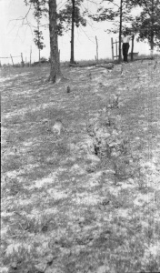
Caption: Superior Coal Mine No.2 Gillespie
Credit: Illinois State Geological Survey
Library No.: M-1042


![[[:Superior No. 2|Superior No. 2]]](https://go.illinois.edu/ILMImages/macoupin/thumbnails/m0503_IL_1102_th.jpg)
![[[:Superior No. 1|Superior No. 1]]](https://go.illinois.edu/ILMImages/macoupin/thumbnails/m0413_IL_1126_th.jpg)
![[[:Superior No. 4|Superior No. 4]]](https://go.illinois.edu/ILMImages/macoupin/thumbnails/m0188_IL_1130_th.jpg)
![[[:Superior No. 3|Superior No. 3]]](https://go.illinois.edu/ILMImages/macoupin/thumbnails/m0066_IL_1124_th.jpg)
