File:M0653.jpg
Size of this preview: 800 × 452 pixels. Other resolution: 3,390 × 1,915 pixels.
Original file (3,390 × 1,915 pixels, file size: 3.51 MB, MIME type: image/jpeg)
CLICK HERE TO DOWNLOAD THE HIGH RESOLUTION IMAGE. FILE SIZE MAY BE LARGE(Note:this file is usually better quality than "original file" linked above)
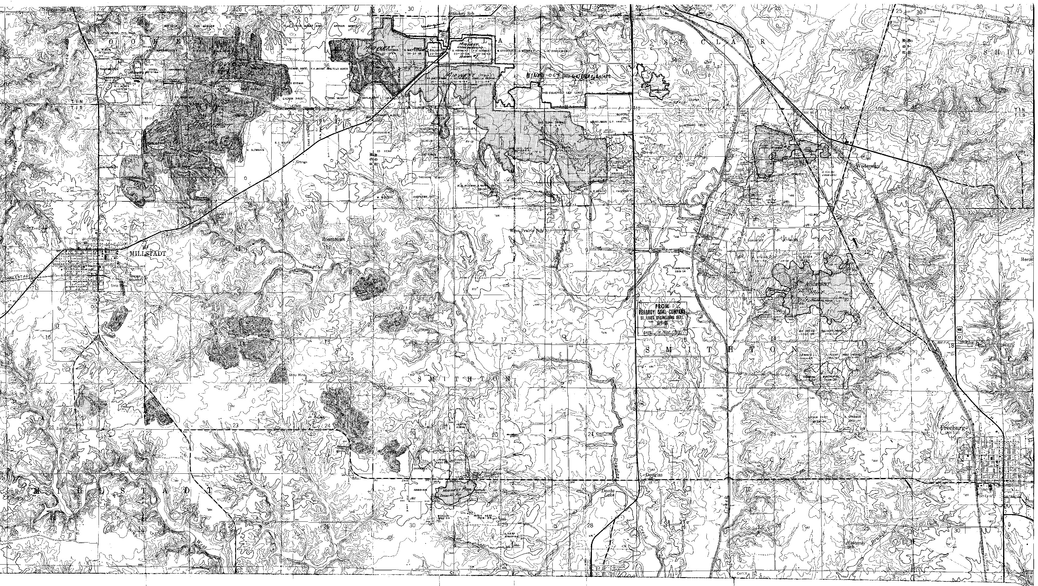
| Mine Index(s): | 0653, 4279, 0682, 4275, 4282 |
| Mine Company: | Peabody Coal Company |
| Mine Name | Midwest Strip Mine,Douglas Field Mine,Midwest Mine |
| Map Date | 3-14-1969 |
| Map Scale | 1:12000 |
| Map Type microfilm/company/wpa/quade | ISGS map library |
| Map Status final,not final, secondary | Final |
| ID Number | 4103.S31 i5.1-61 |
| Used For | pit locations, mine outlines,pit identification, general mine outline |
| Notes | The pits shown on the Freeburg Quadrangle were final, while the portions shown on the Millstadt Quadrangle were not final. |
| Image Credit | |
| Hi-Res Download | Click to download |
File history
Click on a date/time to view the file as it appeared at that time.
| Date/Time | Thumbnail | Dimensions | User | Comment | |
|---|---|---|---|---|---|
| current | 14:55, October 1, 2021 | | 3,390 × 1,915 (3.51 MB) | Cheri (talk | contribs) |
You cannot overwrite this file.