Mine Index Number: 0653
| Company Name:
|
Peabody Coal Company
|
| Mine Name:
|
Midwest Strip Mine
|
| Start Date:
|
1951
|
End Date:
|
January 1971
|
| Type of Mine:
|
Surface
|
| Total acres shown:
|
1,103
|
| Acres after map date:
|
115
|
General Area of mining acres shown:
|
|
|
The area shown is too small for the reported production; production reported for this mine almost certainly includes the production for Midwest Mine No. 3 (mine index 4279) as well as some production for Midwest Radiant No. 1 Mine (mine index 0682).
|
Shaft, Slope, Drift or Tipple Location(s)
| Type
|
County
|
Township-Range
|
Section
|
Part Section
|
| Tipple
|
St. Clair
|
1N 9W
|
34
|
SE NE SW The tipple for Midwest Radiant Fuel Company (mine index 0682) was used by Peabody Midwest Mine.
|
Geology
Geological Problems Reported
Production
| Company
|
Mine Name
|
Date
|
Production (tons)
|
|
|
|
|
|
| Total Production: 14,528,952
|
Production Notes
Coal Report production (if available)
Sources of Data
| ISGS map library, 4103.S31 i5.1-61
|
3-14-1969
|
1:12000
|
1:12000
|
Not final The pit shown is final; pits on the Millstadt quadrangle were not final.
|
Annotated Bibliography (Data source - brief description of information)
| Coal Reports - Production, ownership, years of operation, mine type, seam, depth, thickness.
|
| Directory of Illinois Coal Mines (St. Clair County) - Mine names, mine index, ownership, years of operation.
|
| ISGS map library, 4103.S31 i5.1-61 - Mine outline, mining method.
|
Mine Notes
Mine Images
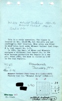
ISGS map library: 4103.S31 i5.1-61
Map Date: 3-14-1969
Coal Co.: Peabody Coal Company
Mine Name: Midwest Strip Mine,Douglas Field Mine,Midwest Mine
Full Res Download
Photographs