File:M0094 quade.jpg: Difference between revisions
No edit summary |
Alan.Myers (talk | contribs) No edit summary |
||
| Line 10: | Line 10: | ||
|Map Scale=1:105000 | |Map Scale=1:105000 | ||
|Map Status=Secondary source | |Map Status=Secondary source | ||
|Map hires=https://wikiimage.isgs.illinois.edu/ilmines/vermilion/m0094_quade_geo.zip | |||
|county1=Vermilion | |county1=Vermilion | ||
|quad1=Danville SW | |quad1=Danville SW | ||
Revision as of 08:56, July 14, 2021
CLICK HERE TO DOWNLOAD THE HIGH RESOLUTION IMAGE. FILE SIZE MAY BE LARGE(Note:this file is usually better quality than "original file" linked above)
| Mine Index(s): | 0094, 0400, 3773,400 ,3773 |
| Mine Company: | Electric Coal Company |
| Mine Name | Electric Mine |
| Map Date | 1-1934 |
| Map Scale | 1:105000 |
| Map Type microfilm/company/wpa/quade | Federal Land Bank Report |
| Map Status final,not final, secondary | Secondary source |
| ID Number | |
| Used For | Mine outline, shaft location |
| Notes | |
| Image Credit | |
| Hi-Res Download | Click to download |
File history
Click on a date/time to view the file as it appeared at that time.
| Date/Time | Thumbnail | Dimensions | User | Comment | |
|---|---|---|---|---|---|
| current | 11:34, March 15, 2021 | 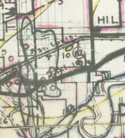 | 402 × 441 (61 KB) | Cheri (talk | contribs) |
You cannot overwrite this file.
File usage
There are no pages that use this file.