|
|
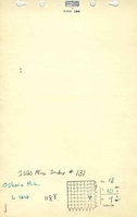
| Line 33: |
Line 33: |
| |Seam=Springfield | | |Seam=Springfield |
| |thick-ave=4.67 | | |thick-ave=4.67 |
| |mining-method_note=RP | | |mining-method=RP |
| }} | | }} |
| ===Geological Problems Reported=== | | ===Geological Problems Reported=== |
Revision as of 15:31, January 11, 2022
Mine Index Number: 0131
| Company Name:
|
Tom Osborn
|
| Mine Name:
|
Osborn No. 2 Mine
|
| Start Date:
|
1938
|
End Date:
|
February 1952
|
| Type of Mine:
|
Underground
|
| Total acres shown:
|
1
|
| Acres after map date:
|
|
General Area of mining acres shown:
|
|
|
|
Shaft, Slope, Drift or Tipple Location(s)
| Type
|
County
|
Township-Range
|
Section
|
Part Section
|
| Main drift
|
Saline
|
10S 7E
|
13
|
SE NE SE
|
Geology
Geological Problems Reported
Production
| Company
|
Mine Name
|
Date
|
Production (tons)
|
Production Notes
Coal Report production (if available)
Sources of Data
| Microfilm, document 352809
|
12-27-1955
|
1:1200
|
1:1324
|
Secondary source
|
Annotated Bibliography (Data source - brief description of information)
| Coal Reports - Production, ownership, years of operation, mining method.
|
| Directory of Illinois Coal Mines (Saline County) - Mine names, mine index, ownership, years of operation.
|
| Mine notes (Saline County) - Mine type, drift location, seam, thickness.
|
| Microfilm map, document 352809, reel 03140, frame 361, map of Tarleton Mine (mine index 132) - Drift location, mine outline, mining method.
|
Mine Notes
Mine Images
Photographs