4343: Difference between revisions
No edit summary |
Alan.Myers (talk | contribs) No edit summary |
||
| Line 9: | Line 9: | ||
|quad1=Steeleville | |quad1=Steeleville | ||
|quad2=Percy | |quad2=Percy | ||
|year-start=9999 | |||
|year-end=9999 | |||
|Latitude=0 | |Latitude=0 | ||
|Longitude=0 | |Longitude=0 | ||
Revision as of 08:22, April 8, 2022
Mine Index Number: 4343
| Company Name: | Unknown | ||
|---|---|---|---|
| Mine Name: | |||
| Start Date: | Unknown | End Date: | Unknown |
| Type of Mine: | |||
| Total acres shown: | |||
| Acres after map date: | General Area of mining acres shown: | ||
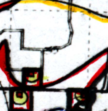
Shaft, Slope, Drift or Tipple Location(s)
| Type | County | Township-Range | Section | Part Section |
|---|
| Slope | Randolph | 5S 5W | 35 | NW SE SW |
Geology
| Thickness (ft) | |||||
|---|---|---|---|---|---|
| Seam | Depth (ft) | Min | Max | Ave | Mining Method |
| Herrin | 11 | 6.0 |
Geological Problems Reported
Production
| Company | Mine Name | Date | Production (tons) |
Production Notes
Coal Report production (if available)
Sources of Data
| Source Map | Map Date | Original Scale | Digitized Scale | Map Type |
| Federal Land Bank Report | 1934 |
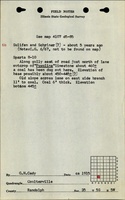
| ISGS field notes (G. H. Cady) | circa 1915 |
Annotated Bibliography (Data source - brief description of information)
Mine Notes
Mine Images
Photographs