Mine Index Number: 4343
| Company Name:
|
Unknown
|
| Mine Name:
|
|
| Start Date:
|
Unknown
|
End Date:
|
Unknown
|
| Type of Mine:
|
|
| Total acres shown:
|
|
| Acres after map date:
|
|
General Area of mining acres shown:
|
|
|
|
Shaft, Slope, Drift or Tipple Location(s)
| Type
|
County
|
Township-Range
|
Section
|
Part Section
|
| Slope
|
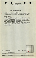
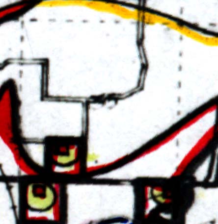
Randolph
|
5S 5W
|
35
|
NW SE SW
|
Geology
Geological Problems Reported
Production
| Company
|
Mine Name
|
Date
|
Production (tons)
|
Production Notes
Coal Report production (if available)
Sources of Data
| Federal Land Bank Report
|
1934
|
|
|
|
| ISGS field notes (G. H. Cady)
|
circa 1915
|
|
|
|
Annotated Bibliography (Data source - brief description of information)
Mine Notes
Mine Images
Photographs