0664: Difference between revisions
Kate.O'Brien (talk | contribs) (Created page with "{{Sidebar Info Query}} {{Header |checked=1st Entry |unlocated=No |shown_on_map=Yes |Mine-index=0664 |Coal_co=Sahara Coal Company, Inc. |Mine Name Header=Sahara No. 5 Mine |min...") |
Alan.Myers (talk | contribs) No edit summary |
||
| (2 intermediate revisions by 2 users not shown) | |||
| Line 1: | Line 1: | ||
{{Sidebar Info Query}} | {{Sidebar Info Query}} | ||
{{Header | {{Header | ||
|checked= | |checked=Checked OK | ||
|unlocated=No | |unlocated=No | ||
|shown_on_map=Yes | |shown_on_map=Yes | ||
| Line 13: | Line 13: | ||
|year-start=1938 | |year-start=1938 | ||
|year-end=August 1972 | |year-end=August 1972 | ||
|Latitude= | |Latitude=37.71061716 | ||
|Longitude= | |Longitude=-88.68183803 | ||
|Zoom=15 | |Zoom=15 | ||
}} | }} | ||
| Line 51: | Line 51: | ||
{{Production | {{Production | ||
|Company=Bankston Creek Collieries Company | |Company=Bankston Creek Collieries Company | ||
|company_note=Also operated as Fifth Vein Coal Company, as shown on a 1950 map. | |company_note={{#info:Also operated as Fifth Vein Coal Company, as shown on a 1950 map.|note}} | ||
|Mine-Name=Bankston Creek No. 5 | |Mine-Name=Bankston Creek No. 5 | ||
|Date=1938-1950 | |Date=1938-1950 | ||
|Production=6,356,092 | |Production=6,356,092 | ||
|Sum=No | |||
}} | }} | ||
{{Production | {{Production | ||
| Line 61: | Line 62: | ||
|Date=1951-1972 | |Date=1951-1972 | ||
|Production=11,270,620 | |Production=11,270,620 | ||
|Sum=No | |||
| | |||
}} | }} | ||
{{Production | {{Production | ||
|Production=17,626,712 | |Production=17,626,712 | ||
|Sum=Yes | |||
}} | }} | ||
===Production Notes=== | ===Production Notes=== | ||
| Line 76: | Line 76: | ||
{{Source Map | {{Source Map | ||
|Source Map=Microfilm, document 352839 | |Source Map=Microfilm, document 352839 | ||
|Map Date=7-11- | |Map Date=7-11-1972 | ||
|Original Scale=1:2400 | |Original Scale=1:2400 | ||
|Digitized Scale=1:4300 | |Digitized Scale=1:4300 | ||
| Line 86: | Line 86: | ||
|Original Scale=1:6600 | |Original Scale=1:6600 | ||
|Digitized Scale=1:6600 | |Digitized Scale=1:6600 | ||
|Map Type=Secondary | |Map Type=Secondary source | ||
}} | }} | ||
{{Annotated bibliography header}} | {{Annotated bibliography header}} | ||
| Line 94: | Line 94: | ||
{{Annotated bibliography | {{Annotated bibliography | ||
|bibliography=Directory of Illinois Coal Mines (Saline County) - Mine names, mine index, ownership, years of operation. | |bibliography=Directory of Illinois Coal Mines (Saline County) - Mine names, mine index, ownership, years of operation. | ||
}} | }} | ||
{{Annotated bibliography | {{Annotated bibliography | ||
Latest revision as of 11:07, April 12, 2022
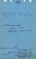
Mine Index Number: 0664
| Company Name: | Sahara Coal Company, Inc. | ||
|---|---|---|---|
| Mine Name: | Sahara No. 5 Mine | ||
| Start Date: | 1938 | End Date: | August 1972 |
| Type of Mine: | Underground | ||
| Total acres shown: | 4,038 | ||
| Acres after map date: | General Area of mining acres shown: | ||
Shaft, Slope, Drift or Tipple Location(s)
| Type | County | Township-Range | Section | Part Section |
|---|
| Main slope | Saline | 9S 5E | 29 | SW SE NW |
| Slope | Saline | 9S 5E | 29 | SE SE NW |
Geology
| Thickness (ft) | |||||
|---|---|---|---|---|---|
| Seam | Depth (ft) | Min | Max | Ave | Mining Method |
| Springfield | 135 | 4.5-5.0 | RPP |
Geological Problems Reported
The coal contained pyrite in nodules and lenses up to 1.5 inches thick. Pyrite was also present as stringers at the base of the seam and locally as fracture fillings along with some calcite.
Production
| Company | Mine Name | Date | Production (tons) |
| Bankston Creek Collieries Company Also operated as Fifth Vein Coal Company, as shown on a 1950 map. | Bankston Creek No. 5 | 1938-1950 | 6,356,092 |
| Sahara Coal Company, Inc. | Sahara No. 5 | 1951-1972 | 11,270,620 |
| Total Production: 17,626,712 | |||
Production Notes
Coal Report production (if available)
Sources of Data
| Source Map | Map Date | Original Scale | Digitized Scale | Map Type |
| Microfilm, document 352839 | 7-11-1972 | 1:2400 | 1:4300 | Final |
| Company, 10-5-49 | 6-23-1977 | 1:6600 | 1:6600 | Secondary source |
Annotated Bibliography (Data source - brief description of information)
| Coal Reports - Production, ownership, years of operation, thickness. |
| Directory of Illinois Coal Mines (Saline County) - Mine names, mine index, ownership, years of operation. |
| Mine notes (Saline County) - Mine type, slope location, seam, depth, thickness. |
| Microfilm map, document 352839, reel 03140, frames 425-441 - Slope locations, mine outline, mining method. |
| ISGS Coal Section files, 10-5-49, coal company compilation map - Mine outline (west, 25-T9S-R4E). |
Mine Notes
Mine Images

![[[:Sahara No. 5|Sahara No. 5]]](https://wikiimage.isgs.illinois.edu/ilmines/saline/thumbnails/m0664_th.jpg)
Photographs