3308: Difference between revisions
No edit summary |
Alan.Myers (talk | contribs) No edit summary |
||
| (One intermediate revision by the same user not shown) | |||
| Line 4: | Line 4: | ||
|unlocated=No | |unlocated=No | ||
|shown_on_map=Yes | |shown_on_map=Yes | ||
|reason_nsm=This area was later partially surface mined by Vinyard No. 1 Mine (mine index | |reason_nsm=This area was later partially surface mined by Vinyard No. 1 Mine (mine index [[0804]]). | ||
|Mine-index=3308 | |Mine-index=3308 | ||
|Coal_co=Silas B. Moore | |Coal_co=Silas B. Moore | ||
| Line 15: | Line 15: | ||
|year-start=1928 | |year-start=1928 | ||
|year-end=1940 | |year-end=1940 | ||
|Latitude= | |Latitude=37.72563091 | ||
|Longitude= | |Longitude=-88.39367385 | ||
|Zoom=15 | |Zoom=15 | ||
}} | }} | ||
| Line 63: | Line 63: | ||
|Date=1928-1938 | |Date=1928-1938 | ||
|Production=15,626{{#info:Production was not listed in the Coal Reports for mines producing less than 1,000 tons per year.|note}} | |Production=15,626{{#info:Production was not listed in the Coal Reports for mines producing less than 1,000 tons per year.|note}} | ||
|Sum=No | |||
}} | }} | ||
{{Production | {{Production | ||
| Line 69: | Line 70: | ||
|Date=1938-1940 | |Date=1938-1940 | ||
|Production=3,735{{#info:Production after map date|note}} | |Production=3,735{{#info:Production after map date|note}} | ||
|Sum=No | |||
| | |||
}} | }} | ||
{{Production | {{Production | ||
|Production=19,361 | |Production=19,361 | ||
|Sum=Yes | |||
}} | }} | ||
===Production Notes=== | ===Production Notes=== | ||
Latest revision as of 14:16, April 14, 2022
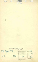
Mine Index Number: 3308
| Company Name: | Silas B. Moore | ||
|---|---|---|---|
| Mine Name: | Moore No. 3 Mine | ||
| Start Date: | 1928 | End Date: | 1940 |
| Type of Mine: | Underground | ||
| Total acres shown: | 10Production indicates approximately 4 acres were mined. | ||
| Acres after map date: | 1 | General Area of mining acres shown: | |
|
This area was later partially surface mined by Vinyard No. 1 Mine (mine index 0804). | |||
Shaft, Slope, Drift or Tipple Location(s)
| Type | County | Township-Range | Section | Part Section |
|---|
| Main slope | Saline | 9S 7E | 23 | SE SE NE |
| Air slope | Saline | 9S 7E | 23 | SE SE NE |
| Air shaft | Saline | 9S 7E | 23 | SE SE NE |
Geology
| Thickness (ft) | |||||
|---|---|---|---|---|---|
| Seam | Depth (ft) | Min | Max | Ave | Mining Method |
| Springfield | 16 | 4.5 | MRP |
Geological Problems Reported
The source map shows one room in the eastern part of the mine was caved. This room was near the slope entrance to the mine and probably did not have enough rock above the coal to make a stable roof. Mining was extended north and west of this area, probably as a result of this roof fall.
Production
| Company | Mine Name | Date | Production (tons) |
| Silas B. Moore | Moore No. 3 | 1928-1938 | 15,626Production was not listed in the Coal Reports for mines producing less than 1,000 tons per year. |
| Silas B. Moore | Moore No. 3 | 1938-1940 | 3,735Production after map date |
| Total Production: 19,361 | |||
Production Notes
Coal Report production (if available)
Sources of Data
| Source Map | Map Date | Original Scale | Digitized Scale | Map Type |
| Microfilm, document 352751 | 3-1938 | 1:2400 | 1:1986 | Not final |
Annotated Bibliography (Data source - brief description of information)
| Coal Reports - Production, ownership, years of operation. |
| Directory of Illinois Coal Mines (Saline County) - Mine names, mine index, ownership, years of operation. |
| Mine notes (Saline County) - Mine type, slope location, seam, depth, thickness. |
| Microfilm map, document 352751, reel 03140, frame 250 - Slope location, mine outline, mining method, geologic problems. |
Mine Notes
Mine Images
Photographs