4107: Difference between revisions
No edit summary |
Alan.Myers (talk | contribs) No edit summary |
||
| Line 4: | Line 4: | ||
|unlocated=No | |unlocated=No | ||
|shown_on_map=Yes | |shown_on_map=Yes | ||
|reason_nsm=Partially surface-mined by Delta Mine (mine index | |reason_nsm=Partially surface-mined by Delta Mine (mine index [[0702]]). | ||
|Mine-index=4107 | |Mine-index=4107 | ||
|Coal_co=Blue Bird Coal Company | |Coal_co=Blue Bird Coal Company | ||
| Line 15: | Line 15: | ||
|year-start=1944 | |year-start=1944 | ||
|year-end=August 1968 | |year-end=August 1968 | ||
|Latitude= | |Latitude=37.71079358 | ||
|Longitude= | |Longitude=-88.75206504 | ||
|Zoom=15 | |Zoom=15 | ||
}} | }} | ||
| Line 56: | Line 56: | ||
|Date=1944-1948 | |Date=1944-1948 | ||
|Production=443,451 | |Production=443,451 | ||
|Sum=No | |||
}} | }} | ||
{{Production | {{Production | ||
| Line 62: | Line 63: | ||
|Date=1949-1953 {{#info: Idle 1953|note}} | |Date=1949-1953 {{#info: Idle 1953|note}} | ||
|Production=35,760 | |Production=35,760 | ||
|Sum=No | |||
}} | }} | ||
{{Production | {{Production | ||
| Line 68: | Line 70: | ||
|Date=1954-1954 | |Date=1954-1954 | ||
|Production=440 | |Production=440 | ||
|Sum=No | |||
}} | }} | ||
{{Production | {{Production | ||
| Line 74: | Line 77: | ||
|Date=1955-1959 | |Date=1955-1959 | ||
|Production=177,666 | |Production=177,666 | ||
|Sum=No | |||
}} | }} | ||
{{Production | {{Production | ||
| Line 80: | Line 84: | ||
|Date=1959-1962 | |Date=1959-1962 | ||
|Production=319,925 | |Production=319,925 | ||
|Sum=No | |||
}} | }} | ||
{{Production | {{Production | ||
| Line 86: | Line 91: | ||
|Date=1963-1968 | |Date=1963-1968 | ||
|Production=925,380 | |Production=925,380 | ||
|Sum=No | |||
| | |||
}} | }} | ||
{{Production | {{Production | ||
|Production=1,902,622 | |Production=1,902,622 | ||
|Sum=Yes | |||
}} | }} | ||
===Production Notes=== | ===Production Notes=== | ||
Revision as of 10:58, April 15, 2022
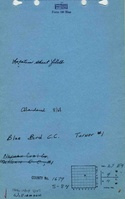
Mine Index Number: 4107
| Company Name: | Blue Bird Coal Company | ||
|---|---|---|---|
| Mine Name: | Turner Mine | ||
| Start Date: | 1944 | End Date: | August 1968 |
| Type of Mine: | Underground | ||
| Total acres shown: | 404 | ||
| Acres after map date: | General Area of mining acres shown: | ||
|
Partially surface-mined by Delta Mine (mine index 0702). | |||
Shaft, Slope, Drift or Tipple Location(s)
| Type | County | Township-Range | Section | Part Section |
|---|
| Main slope | Williamson | 9S 4E | 27 | SW SW NE |
| Air shaft | Williamson | 9S 4E | 27 | NE SW NE |
Geology
| Thickness (ft) | |||||
|---|---|---|---|---|---|
| Seam | Depth (ft) | Min | Max | Ave | Mining Method |
| Springfield | 71-91 | 4.17-4.67 | RPP |
Geological Problems Reported
The source map shows bad top in the E ½ 27-T9S-R4E and in the NW NE 22-T9S-R4E.
Production
| Company | Mine Name | Date | Production (tons) |
| Turner Coal Corporation | Turner No. 1 | 1944-1948 | 443,451 |
| Little Creek Coal Company | Little Creek No. 1 | 1949-1953 Idle 1953 | 35,760 |
| Independent Coal Company | Turner No. 1 | 1954-1954 | 440 |
| McHorn Coal Company | Old Turner | 1955-1959 | 177,666 |
| Norman Coal Company | Turner | 1959-1962 | 319,925 |
| Blue Bird Coal Company | Turner | 1963-1968 | 925,380 |
| Total Production: 1,902,622 | |||
Production Notes
Coal Report production (if available)
Sources of Data
| Source Map | Map Date | Original Scale | Digitized Scale | Map Type |
| Microfilm, document 353294 | 9-21-1968 | 1:2400 | 1:4634 | Final |
Annotated Bibliography (Data source - brief description of information)
| Coal Reports - Production, ownership, years of operation, depth, thickness. |
| Directory of Illinois Coal Mines (Williamson County) - Mine names, mine index, ownership, years of operation. |
| Mine notes (Williamson County) - Mine type, slope location, seam. |
| Microfilm map, document 353294, reel 03142, frames 252, 253 - Slope and shaft locations, mine outline, mining method. |
Mine Notes
Mine Images
![[[:Turner|Turner]]](https://go.illinois.edu/ILMImages/williamson/thumbnails/m4107_th.jpg)
Photographs