4179: Difference between revisions
No edit summary |
Alan.Myers (talk | contribs) No edit summary |
||
| Line 13: | Line 13: | ||
|year-start=1951 | |year-start=1951 | ||
|year-end=March 1953 | |year-end=March 1953 | ||
|Latitude= | |Latitude=37.72843991 | ||
|Longitude= | |Longitude=-88.40393773 | ||
|Zoom=15 | |Zoom=15 | ||
}} | }} | ||
| Line 46: | Line 46: | ||
|Date=1951-1951 | |Date=1951-1951 | ||
|Production=55,427{{#info:The 1951 production was listed in Gallatin County.|note}} | |Production=55,427{{#info:The 1951 production was listed in Gallatin County.|note}} | ||
|Sum=No | |||
}} | }} | ||
{{Production | {{Production | ||
| Line 52: | Line 53: | ||
|Date=1952-1953 | |Date=1952-1953 | ||
|Production=101,613 | |Production=101,613 | ||
|Sum=No | |||
| | |||
}} | }} | ||
{{Production | {{Production | ||
|Production=157,040 | |Production=157,040 | ||
|Sum=Yes | |||
}} | }} | ||
===Production Notes=== | ===Production Notes=== | ||
Latest revision as of 13:36, April 15, 2022
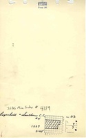
Mine Index Number: 4179
| Company Name: | Regenhardt and Southern Construction Company | ||
|---|---|---|---|
| Mine Name: | Regenhardt and Southern No. 4 Mine | ||
| Start Date: | 1951 | End Date: | March 1953 |
| Type of Mine: | Surface | ||
| Total acres shown: | 16 Production indicates approximately 22 acres were mined. | ||
| Acres after map date: | General Area of mining acres shown: | ||
Shaft, Slope, Drift or Tipple Location(s)
| Type | County | Township-Range | Section | Part Section |
|---|
| Pits | Saline | 9S 7E | 23 | NW |
Geology
| Thickness (ft) | |||||
|---|---|---|---|---|---|
| Seam | Depth (ft) | Min | Max | Ave | Mining Method |
| Springfield | 24 | 4.5 | Surface |
Geological Problems Reported
Production
| Company | Mine Name | Date | Production (tons) |
| Regenhardt and Southern Construction Co. | Regenhardt and Southern No. 4 | 1951-1951 | 55,427The 1951 production was listed in Gallatin County. |
| Regenhardt and Southern Construction Co. | Regenhardt and Southern No. 4 | 1952-1953 | 101,613 |
| Total Production: 157,040 | |||
Production Notes
Coal Report production (if available)
Sources of Data
| Source Map | Map Date | Original Scale | Digitized Scale | Map Type |
| ISGS map library, 4102 a-7, sheet 2 | 1981-1983 | 1:24000 | 1:24000 | Secondary source |
| Microfilm, document 352818 | 5-11-1966 | 1:2400 | 1:2814 | Secondary source |
Annotated Bibliography (Data source - brief description of information)
| Coal Reports - Production, ownership, years of operation. |
| Directory of Illinois Coal Mines (Saline County) - Mine names, mine index, ownership, years of operation. |
| Mine notes (Saline County) - Pit location, seam. |
| ISGS map library, 4102 1-7, sheet 2, work map for Rudement Quadrangle Geologic Map - Mine outline. |
| Microfilm map, document 352818, reel 03140, frame 352 - Mine outline. |
Mine Notes
Mine Images
Photographs