|
|
| Line 18: |
Line 18: |
| |Latitude=37.7829760697194 | | |Latitude=37.7829760697194 |
| |Longitude=-88.9977300019557 | | |Longitude=-88.9977300019557 |
| | |Zoom=15 |
| }} | | }} |
| ==Shaft, Slope, Drift or Tipple Location(s)== | | ==Shaft, Slope, Drift or Tipple Location(s)== |
Revision as of 11:38, July 25, 2022
Mine Index Number: 3978
| Company Name:
|
Coal Stripping Company
|
| Mine Name:
|
Coal Stripping No. 1 Mine
|
| Start Date:
|
1924
|
End Date:
|
January 1931
|
| Type of Mine:
|
Surface
|
| Total acres shown:
|
|
| Acres after map date:
|
|
General Area of mining acres shown:
|
|
|
This mine is part of a larger surface-mined area that was mined by various operators and extends into the Johnston City and Marion Quadrangles to the east and southeast. The tonnage shown below is for all the Coal Stripping pits (including those in the Johnston City and Marion Quadrangles).
|
Shaft, Slope, Drift or Tipple Location(s)
| Type
|
County
|
Township-Range
|
Section
|
Part Section
|
| Tipple / pit
|
Williamson
|
8S 2E
|
33
|
SW SW
|
Geology
| Herrin
|
20-40
|
6.0
|
8.5
|
7.5
|
Surface
|
Geological Problems Reported
A sandstone channel cut out all of the Pennsylvanian rocks above the coal and part of the coal at the northern end of one pit. Some variation in coal thickness was noted.
Production
| Company
|
Mine Name
|
Date
|
Production (tons)
|
|
|
|
|
|
| Total Production: 1,431,896
|
Production Notes
Coal Report production (if available)
Sources of Data
| ISGS map library, 4103.W52 i5.1-130
|
1931
|
1:4800
|
1:4800
|
Secondary source
|
| USGS topographic map
|
PR 1990
|
1:24000
|
1:24000
|
Secondary source
|
Annotated Bibliography (Data source - brief description of information)
| Coal Reports - Production, ownership, years of operation.
|
| Directory of Illinois Coal Mines (Williamson County) - Mine names, mine index, ownership, years of operation.
|
| Mine notes (Williamson County) - Mine type, mine location, depth, thickness, geologic problems.
|
| ISGS map library, 4103.W52 i5.1-130 - Mine outline (ownership).
|
| USGS topographic map, Marion Quadrangle, photorevised 1990 - Mine outline (general area of mining).
|
Mine Notes
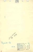
Mine Images
![[[:Coal Stripping No. 1|Coal Stripping No. 1]]](https://wikiimage.isgs.illinois.edu/ilmines/williamson/thumbnails/m3978_geo_th.jpg) These files may not be true to scale and are not georgistered. These files may not be true to scale and are not georgistered.
|
Map Type:
|
ISGS map library
|
| Map ID:
|
4103.W52 i5.1-130
|
| Company:
|
Coal Stripping Company
|
| Mine Name:
|
Coal Stripping No. 1
|
| Caption:
|
|
| Map Date:
|
1931
|
| Map Status:
|
Secondary
|
| Image Credit:
|
|
| Note:
|
ISGS map library, 4103.W52 i5.1-130, apparently a map of drill hole locations and data, author unknown
|
| More Info:
|
M3978 geo.jpg
|
| Full Res Download:These files are true to scale and most are georegistered for gis software. These files may be a very large (>1GB) download!
|
https://wikiimage.isgs.illinois.edu/ilmines/williamson/m3978 geo.zip
|
Photographs