0063: Difference between revisions
Alan.Myers (talk | contribs) No edit summary |
Alan.Myers (talk | contribs) No edit summary |
||
| (5 intermediate revisions by 3 users not shown) | |||
| Line 1: | Line 1: | ||
{{Sidebar Info Query}} | {{Sidebar Info Query}} | ||
{{Header | {{Header | ||
|checked=Checked OK | |||
|unlocated=No | |unlocated=No | ||
|shown_on_map=Yes | |shown_on_map=Yes | ||
| Line 8: | Line 9: | ||
|mine_type=Underground | |mine_type=Underground | ||
|mined-out-area=1,118 | |mined-out-area=1,118 | ||
|indicated=No | |||
|county1=Williamson | |county1=Williamson | ||
|quad1=Herrin | |quad1=Herrin | ||
|year-start=1904 | |year-start=1904 | ||
|year-end=1924 | |year-end=March 1924 | ||
|Latitude=37.8237509626216 | |Latitude=37.8237509626216 | ||
|Longitude=-89.0733574103694 | |Longitude=-89.0733574103694 | ||
|Zoom=13 | |||
}} | }} | ||
==Shaft, Slope, Drift or Tipple Location(s)== | ==Shaft, Slope, Drift or Tipple Location(s)== | ||
| Line 52: | Line 55: | ||
|Date=1904-1920 | |Date=1904-1920 | ||
|Production=6,749,651 | |Production=6,749,651 | ||
|Sum=No | |||
}} | }} | ||
{{Production | {{Production | ||
|Company=Consolidated Coal Company of St. Louis | |Company=Consolidated Coal Company of St. Louis | ||
|Mine-Name=Consolidated No. 8, Clifford No. 8 | |Mine-Name=Consolidated No. 8 | ||
|minename_note=, [[Clifford No. 8]] | |||
|Date=1920-1924 | |Date=1920-1924 | ||
|Production=1,304,201 | |Production=1,304,201 | ||
|Sum=No | |||
}} | }} | ||
{{Production | {{Production | ||
|Production=-------- | |Production=-------- | ||
|Sum=No | |||
}} | }} | ||
{{Production | {{Production | ||
|Production=8,053,852 | |Production=8,053,852 | ||
|Sum=Yes | |||
}} | }} | ||
===Production Notes=== | ===Production Notes=== | ||
| Line 84: | Line 92: | ||
{{Annotated bibliography | {{Annotated bibliography | ||
|bibliography=Directory of Illinois Coal Mines (Williamson County) - Mine names, mine index, ownership, years of operation. | |bibliography=Directory of Illinois Coal Mines (Williamson County) - Mine names, mine index, ownership, years of operation. | ||
}} | }} | ||
{{Annotated bibliography | {{Annotated bibliography | ||
| Line 100: | Line 105: | ||
{{Query-image}} | {{Query-image}} | ||
===Photographs=== | |||
{{Photo Query}} | |||
{{Editwithform}} | {{Editwithform}} | ||
{{#set: Company=Consolidated No. 8}} | {{#set: Company=Consolidated No. 8}} | ||
{{#set: Company=Clifford No. 8}} | {{#set: Company=Clifford No. 8}} | ||
{{Editwithform}} | |||
Latest revision as of 09:12, September 21, 2022
Mine Index Number: 0063
| Company Name: | Consolidated Coal Company of St. Louis | ||
|---|---|---|---|
| Mine Name: | Consolidated No. 8 Mine or Clifford No. 8 Mine | ||
| Start Date: | 1904 | End Date: | March 1924 |
| Type of Mine: | Underground | ||
| Total acres shown: | 1,118 | ||
| Acres after map date: | General Area of mining acres shown: | ||
Shaft, Slope, Drift or Tipple Location(s)
| Type | County | Township-Range | Section | Part Section |
|---|
| Main shaft | Williamson | 8S 1E | 14 | SE NW SW |
| Air shaft | Williamson | 8S 1E | 14 | NE NW SW |
Geology
| Thickness (ft) | |||||
|---|---|---|---|---|---|
| Seam | Depth (ft) | Min | Max | Ave | Mining Method |
| Herrin | 170-180 | 8.0-9.0 | RPP |
Geological Problems Reported
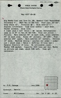
One miner was killed by a gas explosion in 1921. Some faults were noted in the mine. The roof was generally an irregularly bedded gray shale that did not make a good roof, and the soft upper portion of the coal was left to support the shale. When the top coal was mined on retreat, the shale came down readily. At least one roof fall was noted on the source map. Rolls were present and occurred mostly in swags. The floor was a dark gray shale that heaved badly.
Production
| Company | Mine Name | Date | Production (tons) |
| Big Muddy Coal and Iron Company | Big Muddy No. 8 | 1904-1920 | 6,749,651 |
| Consolidated Coal Company of St. Louis | Consolidated No. 8, Clifford No. 8 | 1920-1924 | 1,304,201 |
| Total Production: 8,053,852 | |||
Production Notes
Coal Report production (if available)
Sources of Data
| Source Map | Map Date | Original Scale | Digitized Scale | Map Type |
| Company | 7-1-1924 | 1:2400 | 1:2400 | Final |
Annotated Bibliography (Data source - brief description of information)
| Coal Reports - Production, ownership, years of operation, mining method, depth, thickness, geologic problems. |
| Directory of Illinois Coal Mines (Williamson County) - Mine names, mine index, ownership, years of operation. |
| Mine notes (Williamson County) - Mine type, shaft location, seam, geologic problems. |
| Company map, Old Ben Archive Collection - Shaft locations, mine outline, mining method, geologic problems. |
Mine Notes
Mine Images
![[[:Clifford No. 8|Clifford No. 8]]](https://wikiimage.isgs.illinois.edu/ilmines/williamson/thumbnails/m0063a_th.jpg)
Photographs