3718: Difference between revisions
No edit summary |
No edit summary |
||
| (3 intermediate revisions by 2 users not shown) | |||
| Line 1: | Line 1: | ||
{{Sidebar Info Query}} | {{Sidebar Info Query}} | ||
{{Header | {{Header | ||
|checked= | |checked=Checked OK | ||
|unlocated=No | |unlocated=No | ||
|shown_on_map= | |shown_on_map=No | ||
|reason_nsm=This mine is included within a pit of Mary Moore No. 25 Mine (mine index [[3707]]). | |||
|Mine-index=3718 | |Mine-index=3718 | ||
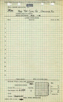
|Coal_co=Red Top Coal Company | |Coal_co=Red Top Coal Company | ||
|Mine Name Header=Red Top Mine | |Mine Name Header=Red Top Mine | ||
|mine_type=Surface | |mine_type=Surface | ||
|mined-out-area=None | |mined-out-area=None | ||
|indicated=No | |indicated=No | ||
|county1=Vermilion | |county1=Vermilion | ||
|quad1=Danville SE | |quad1=Danville SE | ||
|year-start=1950 | |year-start=1950 | ||
|year-end=1950 | |year-end=December 31, 1950 | ||
|Zoom=12 | |Zoom=12 | ||
}} | }} | ||
Latest revision as of 16:41, October 3, 2022
Mine Index Number: 3718
| Company Name: | Red Top Coal Company | ||
|---|---|---|---|
| Mine Name: | Red Top Mine | ||
| Start Date: | 1950 | End Date: | December 31, 1950 |
| Type of Mine: | Surface | ||
| Total acres shown: | None | ||
| Acres after map date: | General Area of mining acres shown: | ||
|
Not Shown On Map. This mine is included within a pit of Mary Moore No. 25 Mine (mine index 3707). | |||
Shaft, Slope, Drift or Tipple Location(s)
| Type | County | Township-Range | Section | Part Section |
|---|
| Tipple | Vermilion | 19N 11W | 28 | NW SE NE |
Geology
| Thickness (ft) | |||||
|---|---|---|---|---|---|
| Seam | Depth (ft) | Min | Max | Ave | Mining Method |
| Herrin | 68 | Surface |
Geological Problems Reported
Production
| Company | Mine Name | Date | Production (tons) |
| Red Top Coal Company | Red Top | 1950-1950 | 1,900 |
| Total Production: 1,900 | |||
Production Notes
Coal Report production (if available)
Sources of Data
| Source Map | Map Date | Original Scale | Digitized Scale | Map Type |
| Microfilm, document 352988 | 1-27-1951 | 1:1200 | 1:1738 | Final |
Annotated Bibliography (Data source - brief description of information)
| Coal Reports - Production, ownership, years of operation. |
| Directory of Illinois Coal Mines (Vermilion County) - Mine names, mine index, ownership, years of operation. |
| Mine notes (Vermilion County) - Mine type, mine location, seam, depth. |
| Microfilm map, document 352988, reel 03141, frame 131 - Mine outline, mining method. |
Mine Notes
Mine Images

Photographs