0102: Difference between revisions
Alan.Myers (talk | contribs) No edit summary |
No edit summary |
||
| Line 1: | Line 1: | ||
{{Sidebar Info Query}} | {{Sidebar Info Query}} | ||
{{Header | {{Header | ||
|checked= | |checked=Checked OK | ||
|unlocated=No | |unlocated=No | ||
|shown_on_map=Yes | |shown_on_map=Yes | ||
| Line 9: | Line 9: | ||
|mine_type=Underground | |mine_type=Underground | ||
|mined-out-area=361 | |mined-out-area=361 | ||
|indicated=No | |||
|county1=La Salle | |county1=La Salle | ||
|quad1=La Salle | |quad1=La Salle | ||
Revision as of 15:50, November 18, 2022
Mine Index Number: 0102
| Company Name: | La Salle County Carbon Coal Company | ||
|---|---|---|---|
| Mine Name: | Cedar Point Mine or La Salle County No. 5 Mine | ||
| Start Date: | 1906 | End Date: | April 1924 |
| Type of Mine: | Underground | ||
| Total acres shown: | 361 | ||
| Acres after map date: | General Area of mining acres shown: | ||
Shaft, Slope, Drift or Tipple Location(s)
| Type | County | Township-Range | Section | Part Section |
|---|
| Main shaft (12x16 ft) | La Salle | 32N 1E | 4 | NE SW SW |
| Air shaft | La Salle | 32N 1E | 4 | NE SW SW |
Geology
| Thickness (ft) | |||||
|---|---|---|---|---|---|
| Seam | Depth (ft) | Min | Max | Ave | Mining Method |
| Colchester | 544-550 | 3.33 | 3.8 | 3.5 | LW |
Geological Problems Reported
The roof of the Colchester Coal was about 18 feet of soapstone separated from the coal by 1 to 2 inches of dark bony shale. The seam had local dips or swales with over 5 feet of relief that made haulage difficult. The Colchester Coal also had lenses, balls and facings of pyrite, as well as calcite and gypsum fracture fillings.
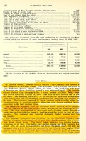
Production
| Company | Mine Name | Date | Production (tons) |
| La Salle County Carbon Coal Company | Cedar Point, La Salle County No. 5 | 1906-1924 | 2,246,731 |
| Total Production: 2,246,731 | |||
Production Notes
Coal Report production (if available)
Sources of Data
| Source Map | Map Date | Original Scale | Digitized Scale | Map Type |
| Microfilm, document 352411 | 3-1924 | 1:2400 | 1:4137 | Final |
Annotated Bibliography (Data source - brief description of information)
| Coal Reports - Production, ownership, years of operation, seam, depth. |
| Directory of Illinois Coal Mines (La Salle County) - Mine names, mine index, ownership, years of operation. |
| Mine notes (La Salle County) - Mine type, shaft location, seam, depth, thickness, geologic problems. |
| Microfilm map, document 352411, reel 03139, frames 78 and 79 - Shaft locations, mine outline, mining method. |
Mine Notes
Mine Images
![[[:La Salle County No. 5|La Salle County No. 5]]](https://wikiimage.isgs.illinois.edu/ilmines/la_salle/thumbnails/m0102_352411_th.jpg)
Photographs