6569: Difference between revisions
Alan.Myers (talk | contribs) m (Text replacement - "Danville SE" to "Danville Southeast") |
No edit summary |
||
| (10 intermediate revisions by 3 users not shown) | |||
| Line 1: | Line 1: | ||
{{Sidebar Info Query}} | {{Sidebar Info Query}} | ||
{{Header | {{Header | ||
|checked=Checked OK | |||
|unlocated=No | |unlocated=No | ||
|shown_on_map=Yes | |shown_on_map=Yes | ||
|Mine-index=6569 | |Mine-index=6569 | ||
|Coal_co=Unknown | |||
|Mine Name Header=Unknown | |||
|mine_type=Underground | |mine_type=Underground | ||
|mined-out-area=2 | |||
|indicated=No | |||
|county1=Vermilion | |county1=Vermilion | ||
|quad1=Danville | |quad1=Danville SE | ||
|year-start=9999 | |year-start=9999 | ||
|datemodend= | |datemodend=Before | ||
|year-end=1945 | |year-end=1945 | ||
|Latitude= | |Latitude=40.063714 | ||
|Longitude= | |Longitude=-87.60111172 | ||
|Zoom= | |Zoom=15 | ||
}} | }} | ||
==Shaft, Slope, Drift or Tipple Location(s)== | ==Shaft, Slope, Drift or Tipple Location(s)== | ||
{{Shaft locations header}} | {{Shaft locations header}} | ||
{{Shaft locations | |||
|shaft_type=Drift | |||
|County=Vermilion | |||
|Town-Range=19N 11W | |||
|Section=34 | |||
|partsection=NW NW SW | |||
}} | |||
{{Shaft locations | {{Shaft locations | ||
|shaft_type=Drift | |shaft_type=Drift | ||
| Line 48: | Line 60: | ||
|Original Scale=1:62500 | |Original Scale=1:62500 | ||
|Digitized Scale=1:62500 | |Digitized Scale=1:62500 | ||
|Map Type=Secondary source | |||
}} | |||
{{Source Map | |||
|Source Map=ISGS map library, 4103.V4 i5.1-107 | |||
|Map Date=Undated | |||
|Original Scale=1:3636 | |||
|Digitized Scale=1:3636 | |||
|Map Type=Secondary source | |Map Type=Secondary source | ||
}} | }} | ||
| Line 53: | Line 72: | ||
{{Annotated bibliography | {{Annotated bibliography | ||
|bibliography=Mine notes - Mine type, location, seam, thickness. | |bibliography=Mine notes - Mine type, location, seam, thickness. | ||
}} | |||
{{Annotated bibliography | |||
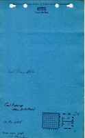
|bibliography=ISGS map library, 4103.V4 i5.1-107, map of Danville Belt Coal Company - Mine outline, drift locations. | |||
}} | }} | ||
==Mine Notes== | ==Mine Notes== | ||
Latest revision as of 16:15, December 6, 2022
Mine Index Number: 6569
| Company Name: | Unknown | ||
|---|---|---|---|
| Mine Name: | Unknown | ||
| Start Date: | Unknown | End Date: | Before 1945 |
| Type of Mine: | Underground | ||
| Total acres shown: | 2 | ||
| Acres after map date: | General Area of mining acres shown: | ||
Shaft, Slope, Drift or Tipple Location(s)
| Type | County | Township-Range | Section | Part Section |
|---|
| Drift | Vermilion | 19N 11W | 34 | NW NW SW |
| Drift | Vermilion | 19N 11W | 34 | NW NW SW |
Geology
| Thickness (ft) | |||||
|---|---|---|---|---|---|
| Seam | Depth (ft) | Min | Max | Ave | Mining Method |
| Herrin | 5.67 | Underground |
Geological Problems Reported
Production
| Company | Mine Name | Date | Production (tons) |
Production Notes
Coal Report production (if available)
Sources of Data
| Source Map | Map Date | Original Scale | Digitized Scale | Map Type |
| Mine notes | 1945 | 1:62500 | 1:62500 | Secondary source |
| ISGS map library, 4103.V4 i5.1-107 | Undated | 1:3636 | 1:3636 | Secondary source |
Annotated Bibliography (Data source - brief description of information)
| Mine notes - Mine type, location, seam, thickness. |
| ISGS map library, 4103.V4 i5.1-107, map of Danville Belt Coal Company - Mine outline, drift locations. |
Mine Notes
Mine Images

Photographs