3585: Difference between revisions
No edit summary |
No edit summary |
||
| (6 intermediate revisions by one other user not shown) | |||
| Line 1: | Line 1: | ||
{{Sidebar Info Query}} | {{Sidebar Info Query}} | ||
{{Header | {{Header | ||
|checked=Checked OK | |||
|unlocated=No | |unlocated=No | ||
|shown_on_map=No | |shown_on_map=No | ||
|reason_nsm=This mine is not shown on the accompanying map due to later surface mining by Morgan mines (mine index 3589). | |reason_nsm=This mine is not shown on the accompanying map due to later surface mining by Morgan mines (mine index [[3589]]). | ||
|Mine-index=3585 | |Mine-index=3585 | ||
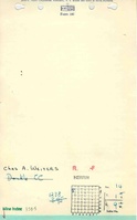
|Coal_co=Charles Weiters | |Coal_co=Charles Weiters | ||
|Mine Name Header=Dunkle Mine | |Mine Name Header=Dunkle Mine | ||
|mine_type=Surface | |mine_type=Surface | ||
|mined-out-area=None | |mined-out-area=None | ||
|after_map=Less than 1 | |||
|indicated=Yes | |||
|county1=St. Clair | |county1=St. Clair | ||
|quad1=Millstadt | |quad1=Millstadt | ||
| Line 40: | Line 43: | ||
{{Production | {{Production | ||
|Company=Charles Weiters | |Company=Charles Weiters | ||
|Mine-Name= | |Mine-Name=Dunkle | ||
|Date=1934-1934 | |Date=1934-1934 | ||
|Production=900 | |Production=900 | ||
|Sum=Yes | |||
| | |||
}} | }} | ||
===Production Notes=== | ===Production Notes=== | ||
| Line 57: | Line 55: | ||
{{Source map header}} | {{Source map header}} | ||
{{Source Map | {{Source Map | ||
|Source Map=ISGS mined-out area map | |Source Map=ISGS mined-out area map, Area 27 | ||
|Map Date=1950 | |Map Date=1950 | ||
|Original Scale=1:62500 | |Original Scale=1:62500 | ||
| Line 71: | Line 69: | ||
}} | }} | ||
{{Annotated bibliography | {{Annotated bibliography | ||
|bibliography=Mine notes (St. Clair County) - Mine | |bibliography=Mine notes (St. Clair County) - Mine location, seam, depth, thickness. | ||
}} | }} | ||
{{Annotated bibliography | {{Annotated bibliography | ||
|bibliography=ISGS mined-out area map - Mine location. | |bibliography=ISGS mined-out area map, Area 27 - Mine location. | ||
}} | }} | ||
{{Annotated bibliography | {{Annotated bibliography | ||
|bibliography=Coal Section files, undated work map on USGS topographic map, Waterloo (15') Quadrangle - Mine location. | |bibliography=Coal Section files, undated work map on USGS topographic map, Waterloo (15') Quadrangle - Mine location, mine type. | ||
}} | }} | ||
==Mine Notes== | ==Mine Notes== | ||
| Line 88: | Line 86: | ||
{{Photo Query}} | {{Photo Query}} | ||
{{Editwithform}} | {{Editwithform}} | ||
{{Editwithform}} | {{Editwithform}} | ||
Latest revision as of 16:55, December 16, 2022
Mine Index Number: 3585
| Company Name: | Charles Weiters | ||
|---|---|---|---|
| Mine Name: | Dunkle Mine | ||
| Start Date: | 1934 | End Date: | 1934 |
| Type of Mine: | Surface | ||
| Total acres shown: | None | ||
| Production Indicated Acres: | Less than 1 | General Area of mining acres shown: | |
|
Not Shown On Map. This mine is not shown on the accompanying map due to later surface mining by Morgan mines (mine index 3589). | |||
Shaft, Slope, Drift or Tipple Location(s)
| Type | County | Township-Range | Section | Part Section |
|---|
| Pit | St. Clair | 1S 9W | 14 | SW NW NW |
Geology
| Thickness (ft) | |||||
|---|---|---|---|---|---|
| Seam | Depth (ft) | Min | Max | Ave | Mining Method |
| Herrin | 18-20 | 6.0 | Surface |
Geological Problems Reported
Production
| Company | Mine Name | Date | Production (tons) |
| Charles Weiters | Dunkle | 1934-1934 | 900 |
| Total Production: 900 | |||
Production Notes
Coal Report production (if available)
Sources of Data
| Source Map | Map Date | Original Scale | Digitized Scale | Map Type |
| ISGS mined-out area map, Area 27 | 1950 | 1:62500 | 1:62500 | Secondary source |
Annotated Bibliography (Data source - brief description of information)
| Coal Reports - Production, ownership, years of operation. |
| Directory of Illinois Coal Mines (St. Clair County) - Mine names, mine index, ownership, years of operation. |
| Mine notes (St. Clair County) - Mine location, seam, depth, thickness. |
| ISGS mined-out area map, Area 27 - Mine location. |
| Coal Section files, undated work map on USGS topographic map, Waterloo (15') Quadrangle - Mine location, mine type. |
Mine Notes
Mine Images

Photographs