Mine Index Number: 3585
| Company Name:
|
Charles Weiters
|
| Mine Name:
|
Dunkle Mine
|
| Start Date:
|
1934
|
End Date:
|
1934
|
| Type of Mine:
|
Surface
|
| Total acres shown:
|
None
|
| Production Indicated Acres:
|
Less than 1
|
General Area of mining acres shown:
|
|
|
Not Shown On Map. This mine is not shown on the accompanying map due to later surface mining by Morgan mines (mine index 3589).
|
Shaft, Slope, Drift or Tipple Location(s)
| Type
|
County
|
Township-Range
|
Section
|
Part Section
|
| Pit
|
St. Clair
|
1S 9W
|
14
|
SW NW NW
|
Geology
Geological Problems Reported
Production
| Company
|
Mine Name
|
Date
|
Production (tons)
|
Production Notes
Coal Report production (if available)
Sources of Data
| ISGS mined-out area map, Area 27
|
1950
|
1:62500
|
1:62500
|
Secondary source
|
Annotated Bibliography (Data source - brief description of information)
| Coal Reports - Production, ownership, years of operation.
|
| Directory of Illinois Coal Mines (St. Clair County) - Mine names, mine index, ownership, years of operation.
|
| Mine notes (St. Clair County) - Mine location, seam, depth, thickness.
|
| ISGS mined-out area map, Area 27 - Mine location.
|
| Coal Section files, undated work map on USGS topographic map, Waterloo (15') Quadrangle - Mine location, mine type.
|
Mine Notes
Mine Images
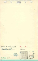
Coal Section work map:
Map Date: Undated
Coal Co.: Charles Weiters
Mine Name: Dunkle Mine
Photographs