4109: Difference between revisions
Alan.Myers (talk | contribs) No edit summary |
No edit summary |
||
| (One intermediate revision by the same user not shown) | |||
| Line 4: | Line 4: | ||
|unlocated=No | |unlocated=No | ||
|shown_on_map=No | |shown_on_map=No | ||
|reason_nsm=Not shown on the accompanying map | |reason_nsm=Not shown on the accompanying map due to later surface mining by the Amax Delta Mine (mine index [[0702]]). Old un-named works were shown to the northwest of this mine, which were also stripped out by the Delta Mine. | ||
|Mine-index=4109 | |Mine-index=4109 | ||
|Coal_co=Blue Blaze Coal Company | |Coal_co=Blue Blaze Coal Company | ||
|Mine Name Header=Blue Blaze Mine | |Mine Name Header=Blue Blaze Mine | ||
|mine_type=Underground | |mine_type=Underground | ||
|mined-out-area= | |mined-out-area=None | ||
|indicated= | |after_map=3 | ||
|indicated=Yes | |||
|county1=Williamson | |county1=Williamson | ||
|quad1=Crab Orchard | |quad1=Crab Orchard | ||
| Line 87: | Line 88: | ||
{{Source Map | {{Source Map | ||
|Source Map=Microfilm, document 353147 | |Source Map=Microfilm, document 353147 | ||
|Map Date=9-18- | |Map Date=9-18-1938 | ||
|Original Scale=1:1200 | |Original Scale=1:1200 | ||
|Digitized Scale=1:1200 | |Digitized Scale=1:1200 | ||
Latest revision as of 15:03, June 26, 2023
Mine Index Number: 4109
| Company Name: | Blue Blaze Coal Company | ||
|---|---|---|---|
| Mine Name: | Blue Blaze Mine | ||
| Start Date: | 1934 | End Date: | 1938 |
| Type of Mine: | Underground | ||
| Total acres shown: | None | ||
| Production Indicated Acres: | 3 | General Area of mining acres shown: | |
|
Not Shown On Map. Not shown on the accompanying map due to later surface mining by the Amax Delta Mine (mine index 0702). Old un-named works were shown to the northwest of this mine, which were also stripped out by the Delta Mine. | |||
Shaft, Slope, Drift or Tipple Location(s)
| Type | County | Township-Range | Section | Part Section |
|---|
| Main slope | Williamson | 9S 4E | 28 | NW NW SW |
| Air slope | Williamson | 9S 4E | 28 | NW NW SW |
Geology
| Thickness (ft) | |||||
|---|---|---|---|---|---|
| Seam | Depth (ft) | Min | Max | Ave | Mining Method |
| Herrin | 10 | 5.17 | MRP |
Geological Problems Reported
Production
| Company | Mine Name | Date | Production (tons) |
| Blue Blaze Coal Company | Blue Blaze | 1934-1935 | 4,690 |
| Waugh | Blue Blaze | 1935-1935 | 1,895 |
| Blue Blaze Coal Company | Blue Blaze | 1936-1938 | 4,835 |
| Total Production: 11,420 | |||
Production Notes
Coal Report production (if available)
Sources of Data
| Source Map | Map Date | Original Scale | Digitized Scale | Map Type |
| Microfilm, document 353147 | 9-18-1938 | 1:1200 | 1:1200 | Final |
Annotated Bibliography (Data source - brief description of information)
| Coal Reports - Production, ownership, years of operation, mining method. |
| Directory of Illinois Coal Mines (Williamson County) - Mine names, mine index, ownership, years of operation. |
| Mine notes (Williamson County) - Mine type, slope location, seam, depth, thickness. |
| Microfilm map, document 353147, reel 03142, frame 26 - Slope locations, mine outline, mining method. |
Mine Notes
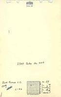
Mine Images
![[[:Blue Blaze|Blue Blaze]]](https://go.illinois.edu/ILMImages/williamson/thumbnails/m4109_th.jpg)
Photographs