4141: Difference between revisions
(Created page with "{{Sidebar Info Query}} {{Header |checked=1st Entry |unlocated=No |shown_on_map=Yes |Mine-index=4141 |Coal_co=Gib Henson Coal Company |Mine Name Header=Henson Mine |mine_type=U...") |
No edit summary |
||
| (4 intermediate revisions by 3 users not shown) | |||
| Line 1: | Line 1: | ||
{{Sidebar Info Query}} | {{Sidebar Info Query}} | ||
{{Header | {{Header | ||
|checked= | |checked=Checked OK | ||
|unlocated=No | |unlocated=No | ||
|shown_on_map=Yes | |shown_on_map=Yes | ||
|reason_nsm=The area shown is too large for the reported production. J.H. Hughes found a slope in this vicinity about 1926, which is further evidence of previous ownership. The general area of mining in the northeastern part of the mine was later surface-mined by mine index [[6853]]. | |||
|Mine-index=4141 | |Mine-index=4141 | ||
|Coal_co=Gib Henson Coal Company | |Coal_co=Gib Henson Coal Company | ||
|Mine Name Header=Henson Mine | |Mine Name Header=Henson Mine | ||
|mine_type=Underground | |mine_type=Underground | ||
|mined-out-area=27 | |mined-out-area=27 | ||
|after_map=13 | |||
|indicated=Yes | |||
|county1=Williamson | |county1=Williamson | ||
|quad1=Crab Orchard | |quad1=Crab Orchard | ||
|year-start=1927 | |year-start=1927 | ||
|year-end=1941 | |year-end=1941 | ||
|Latitude= | |Latitude=37.69979101 | ||
|Longitude= | |Longitude=-88.79400404 | ||
|Zoom=15 | |Zoom=15 | ||
}} | }} | ||
| Line 51: | Line 54: | ||
}} | }} | ||
===Geological Problems Reported=== | ===Geological Problems Reported=== | ||
The source map indicates that mining holed into Steel Tipple No. 2 Mine (mine index 4137). | The source map indicates that mining holed into Steel Tipple No. 2 Mine (mine index [[4137]]). | ||
==Production== | ==Production== | ||
| Line 61: | Line 64: | ||
|Date=1927-1927 | |Date=1927-1927 | ||
|Production=2,320 | |Production=2,320 | ||
|Sum=No | |||
}} | |||
{{Production | |||
|Company=Rentfro and Springhart | |||
|Mine-Name=Rentfro and Springhart | |||
|Date=1928-1930 | |||
|Production=6,708 | |||
|Sum=No | |||
}} | }} | ||
{{Production | {{Production | ||
| Line 67: | Line 78: | ||
|Date=1931-1934 | |Date=1931-1934 | ||
|Production=16,000 | |Production=16,000 | ||
|Sum=No | |||
}} | }} | ||
{{Production | {{Production | ||
|Company= | |Company=Springhart Brothers | ||
|Mine-Name= | |Mine-Name=Springhart No. 2 | ||
|Date= | |Date=1935-1939 | ||
|Production= | |Production=27,123 | ||
|Sum=No | |||
| | |||
}} | }} | ||
{{Production | {{Production | ||
| Line 85: | Line 92: | ||
|Date=1939-1939 | |Date=1939-1939 | ||
|Production=130 | |Production=130 | ||
|Sum=No | |||
}} | }} | ||
{{Production | {{Production | ||
|Company= | |Company=Gib Henson Coal Company | ||
|Mine-Name= | |Mine-Name=Henson | ||
|Date= | |Date=1940-1941 | ||
|Production= | |Production=1,429 | ||
|Sum=No | |||
}} | }} | ||
{{Production | {{Production | ||
|Production= | |Production=53,710 | ||
|Sum=Yes | |||
| | |||
}} | }} | ||
===Production Notes=== | ===Production Notes=== | ||
| Line 105: | Line 112: | ||
{{Source map header}} | {{Source map header}} | ||
{{Source Map | {{Source Map | ||
|Source Map= | |Source Map=State archive, msha_558_01 | ||
|Map Date=1-18-1942 | |Map Date=1-18-1942 | ||
|Original Scale=1:1200 | |Original Scale=1:1200 | ||
|Digitized Scale=1: | |Digitized Scale=1:1200 | ||
|Map Type=Final | |Map Type=Final | ||
}} | }} | ||
| Line 129: | Line 136: | ||
}} | }} | ||
{{Annotated bibliography | {{Annotated bibliography | ||
|bibliography= | |bibliography=State archive map, msha_558_01 - Slope and shaft locations, mine outline, mining method, geologic problems. | ||
}} | }} | ||
{{Annotated bibliography | {{Annotated bibliography | ||
Latest revision as of 14:10, June 27, 2023
Mine Index Number: 4141
| Company Name: | Gib Henson Coal Company | ||
|---|---|---|---|
| Mine Name: | Henson Mine | ||
| Start Date: | 1927 | End Date: | 1941 |
| Type of Mine: | Underground | ||
| Total acres shown: | 27 | ||
| Production Indicated Acres: | 13 | General Area of mining acres shown: | |
|
The area shown is too large for the reported production. J.H. Hughes found a slope in this vicinity about 1926, which is further evidence of previous ownership. The general area of mining in the northeastern part of the mine was later surface-mined by mine index 6853. | |||
Shaft, Slope, Drift or Tipple Location(s)
| Type | County | Township-Range | Section | Part Section |
|---|
| Main slope, No. 2 | Williamson | 9S 4E | 32 | SW NE NW |
| Air shaft | Williamson | 9S 4E | 32 | NW NE NW |
| Slope No. 1 | Williamson | 9S 4E | 32 | NE NE NW |
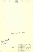
Geology
| Thickness (ft) | |||||
|---|---|---|---|---|---|
| Seam | Depth (ft) | Min | Max | Ave | Mining Method |
| Springfield | 32-35 | 4.5 | MRP |
Geological Problems Reported
The source map indicates that mining holed into Steel Tipple No. 2 Mine (mine index 4137).
Production
| Company | Mine Name | Date | Production (tons) |
| Ensminger and Rentfro | Ensminger and Rentfro | 1927-1927 | 2,320 |
| Rentfro and Springhart | Rentfro and Springhart | 1928-1930 | 6,708 |
| Springhart Brothers | Springhart No. 1 | 1931-1934 | 16,000 |
| Springhart Brothers | Springhart No. 2 | 1935-1939 | 27,123 |
| Cogdil Coal Company | Cogdil | 1939-1939 | 130 |
| Gib Henson Coal Company | Henson | 1940-1941 | 1,429 |
| Total Production: 53,710 | |||
Production Notes
Coal Report production (if available)
Sources of Data
| Source Map | Map Date | Original Scale | Digitized Scale | Map Type |
| State archive, msha_558_01 | 1-18-1942 | 1:1200 | 1:1200 | Final |
| Company, 4103.W52 i5.1-82 | 1-9-1941 | 1:1200 | 1:1200 | Not final |
Annotated Bibliography (Data source - brief description of information)
| Coal Reports - Production, ownership, years of operation, mining method. |
| Directory of Illinois Coal Mines (Williamson County) - Mine names, mine index, ownership, years of operation. |
| Mine notes (Williamson County) - Mine type, slope location, seam, depth, thickness. |
| State archive map, msha_558_01 - Slope and shaft locations, mine outline, mining method, geologic problems. |
| Company map, ISGS map library, 4103.W52 i5.1-82 - Mine outline (east, north, northwest), slope and air shaft locations. |
| Microfilm map, document 353159, reel 03142, frame 46 - Mine ownership, years of operation. |
Mine Notes
Mine Images
![[[:Henson|Henson]]](https://go.illinois.edu/ILMImages/williamson/thumbnails/m4141b_th.jpg)
![[[:Henson|Henson]]](https://go.illinois.edu/ILMImages/williamson/thumbnails/m4141_msha_558_01_th.jpg)
Photographs