0025: Difference between revisions
(Created page with "{{Sidebar Info Query}} {{Header |checked=1st Entry |unlocated=No |shown_on_map=Yes |Mine-index=0025 |Coal_co=Clark Coal and Coke Company |Mine Name Header=Empire No. 2 mine |m...") |
Alan.Myers (talk | contribs) No edit summary |
||
| (One intermediate revision by one other user not shown) | |||
| Line 1: | Line 1: | ||
{{Sidebar Info Query}} | {{Sidebar Info Query}} | ||
{{Header | {{Header | ||
|checked= | |checked=Checked OK | ||
|unlocated=No | |unlocated=No | ||
|shown_on_map=Yes | |shown_on_map=Yes | ||
|reason_nsm=The mined area shown on the accompanying map includes the Empire No. 2 Mine, Hilltop Mine (mine index [[3031]]) and New Star Mine (mine index [[7211]]). | |||
|Mine-index=0025 | |Mine-index=0025 | ||
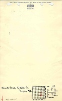
|Coal_co=Clark Coal and Coke Company | |Coal_co=Clark Coal and Coke Company | ||
|Mine Name Header=Empire No. 2 mine | |Mine Name Header=Empire No. 2 mine | ||
|mine_type=Underground | |mine_type=Underground | ||
|mined-out-area=1,267 | |mined-out-area=1,267 | ||
|indicated=No | |indicated=No | ||
|county1=Peoria | |county1=Peoria | ||
| Line 14: | Line 15: | ||
|year-start=1904 | |year-start=1904 | ||
|year-end=January 1924 | |year-end=January 1924 | ||
|Latitude= | |Latitude=40.67008725 | ||
|Longitude= | |Longitude=-89.68742602 | ||
|Zoom=15 | |Zoom=15 | ||
}} | }} | ||
| Line 54: | Line 55: | ||
}} | }} | ||
===Geological Problems Reported=== | ===Geological Problems Reported=== | ||
The roof consisted of 2 inches of draw slate with 2 to 12 inches of dark shale above. Sometimes a thin limestone band was found in the shale, but the cap rock was generally 18 inches of sandstone. The shale always came down where it was thin, and frequent concretions were noted in the shale. The roof was considered poor. Clay slips were sometimes encountered. The seam was uniform with no persistent bands of impurities. Pyrite nodules were occasionally encountered, and pyrite was also seen in vertical streaks. | The roof consisted of 2 inches of draw slate with 2 to 12 inches of dark shale above. Sometimes a thin limestone band was found in the shale, but the cap rock was generally 18 inches of sandstone. The shale always came down where it was thin, and frequent concretions were noted in the shale. The roof was considered poor. Clay slips were sometimes encountered. The seam was uniform with no persistent bands of impurities. Pyrite nodules were occasionally encountered, and pyrite was also seen in vertical streaks. | ||
==Production== | ==Production== | ||
Latest revision as of 09:54, July 14, 2023
Mine Index Number: 0025
| Company Name: | Clark Coal and Coke Company | ||
|---|---|---|---|
| Mine Name: | Empire No. 2 mine | ||
| Start Date: | 1904 | End Date: | January 1924 |
| Type of Mine: | Underground | ||
| Total acres shown: | 1,267 | ||
| Acres after map date: | General Area of mining acres shown: | ||
|
The mined area shown on the accompanying map includes the Empire No. 2 Mine, Hilltop Mine (mine index 3031) and New Star Mine (mine index 7211). | |||
Shaft, Slope, Drift or Tipple Location(s)
| Type | County | Township-Range | Section | Part Section |
|---|
| Main shaft | Peoria | 8N 7E | 10 | SE NW SE This shaft location is the same as the concurrently-operating Star Mine (mine index 7211). No separate shaft could be found on the source map. |
| Air shaft | Peoria | 8N 7E | 10 | SE NW SE |
| Air shaft | Peoria | 8N 7E | 15 | NW SW SE |
Geology
| Thickness (ft) | |||||
|---|---|---|---|---|---|
| Seam | Depth (ft) | Min | Max | Ave | Mining Method |
| Springfield | 90-185 | 3.0 | 4.5 | 4.0 | RPP Pillars were drawn where possible |
Geological Problems Reported
The roof consisted of 2 inches of draw slate with 2 to 12 inches of dark shale above. Sometimes a thin limestone band was found in the shale, but the cap rock was generally 18 inches of sandstone. The shale always came down where it was thin, and frequent concretions were noted in the shale. The roof was considered poor. Clay slips were sometimes encountered. The seam was uniform with no persistent bands of impurities. Pyrite nodules were occasionally encountered, and pyrite was also seen in vertical streaks.
Production
| Company | Mine Name | Date | Production (tons) |
| Clark Coal and Coke Company | B | 1904-1907 | 227,940 |
| Clark Coal and Coke Company | Empire No. 2 | 1907-1924 | 3,529,652 |
| Total Production: 3,757,592 | |||
Production Notes
Coal Report production (if available)
Sources of Data
| Source Map | Map Date | Original Scale | Digitized Scale | Map Type |
| Microfilm, document 352149 | Undated | 1:2400 | 1:4965 | Undated |
Annotated Bibliography (Data source - brief description of information)
| Coal Reports - Production, ownership, years of operation, depth. |
| Directory of Illinois Coal Mines (Peoria County) - Mine names, mine index, ownership, years of operation. |
| Mine notes (Peoria County) - Shaft location, thickness, geologic problems. |
| Microfilm map, document 352149, reel 03138, frames 170-173 - Shaft locations, mine outline, mining method. |
Mine Notes
Mine Images
![[[:Empire|Empire]]](https://go.illinois.edu/ILMImages/peoria/thumbnails/m0025_IL_2608_05_geo_th.jpg)

Photographs