3685: Difference between revisions
No edit summary |
No edit summary |
||
| Line 9: | Line 9: | ||
|mine_type=Underground | |mine_type=Underground | ||
|mined-out-area=2 | |mined-out-area=2 | ||
|indicated=No | |||
|county1=Vermilion | |county1=Vermilion | ||
|quad1=Danville SE | |quad1=Danville SE | ||
| Line 25: | Line 26: | ||
|Town-Range=19N 11W | |Town-Range=19N 11W | ||
|Section=17 | |Section=17 | ||
|partsection=NW SE SE {{#info: The slope & shaft shown for this mine are the same as for Schafer No. 6 Mine (mine index 3686). Mining took place in the Danville Coal after mining ceased in the lower seam.|note}} | |partsection=NW SE SE {{#info: The slope & shaft shown for this mine are the same as for Schafer No. 6 Mine (mine index [[3686]]). Mining took place in the Danville Coal after mining ceased in the lower seam.|note}} | ||
}} | }} | ||
{{Shaft locations | {{Shaft locations | ||
| Line 32: | Line 33: | ||
|Town-Range=19N 11W | |Town-Range=19N 11W | ||
|Section=17 | |Section=17 | ||
|partsection=NW SE SE {{#info: The slope & shaft shown for this mine are the same as for Schafer No. 6 Mine (mine index 3686). Mining took place in the Danville Coal after mining ceased in the lower seam.|note}} | |partsection=NW SE SE {{#info: The slope & shaft shown for this mine are the same as for Schafer No. 6 Mine (mine index [[3686]]). Mining took place in the Danville Coal after mining ceased in the lower seam.|note}} | ||
}} | }} | ||
==Geology== | ==Geology== | ||
Revision as of 16:36, September 6, 2022
Mine Index Number: 3685
| Company Name: | Schafer Brothers Coal Company | ||
|---|---|---|---|
| Mine Name: | Schafer No. 7 Mine | ||
| Start Date: | 1938 | End Date: | 1945 |
| Type of Mine: | Underground | ||
| Total acres shown: | 2 | ||
| Acres after map date: | General Area of mining acres shown: | ||
Shaft, Slope, Drift or Tipple Location(s)
| Type | County | Township-Range | Section | Part Section |
|---|
| Main slope | Vermilion | 19N 11W | 17 | NW SE SE The slope & shaft shown for this mine are the same as for Schafer No. 6 Mine (mine index 3686). Mining took place in the Danville Coal after mining ceased in the lower seam. |
| Air shaft | Vermilion | 19N 11W | 17 | NW SE SE The slope & shaft shown for this mine are the same as for Schafer No. 6 Mine (mine index 3686). Mining took place in the Danville Coal after mining ceased in the lower seam. |
Geology
| Thickness (ft) | |||||
|---|---|---|---|---|---|
| Seam | Depth (ft) | Min | Max | Ave | Mining Method |
| Danville | 50 | 5.5-7.0 | RPB |
Geological Problems Reported
Production
| Company | Mine Name | Date | Production (tons) |
| Schafer Brothers Coal Company | Schafer No. 7 | 1938-1944 | 10,548 |
| Schafer and Fritz Coal Company | Schafer No. 7 | 1944-1944 | 499 |
| Schafer Brothers Coal Company | Schafer No. 7 | 1945-1945 | 356 |
| Total Production: 11,403 | |||
Production Notes
Coal Report production (if available)
Sources of Data
| Source Map | Map Date | Original Scale | Digitized Scale | Map Type |
| Company, 4103.v4 i5.1-63 | 6-19-1941 | 1:1200 | 1:1200 | Not final |
Annotated Bibliography (Data source - brief description of information)
| Coal Reports - Production, ownership, years of operation. |
| Directory of Illinois Coal Mines (Vermilion County) - Mine names, mine index, ownership, years of operation. |
| Mine notes (Vermilion County) - Mine type, slope & shaft location, seam, depth, thickness. |
| Company map, ISGS map library, 4103.v4 i5.1-63 - Slope & shaft locations, mine outline, mining method. |
Mine Notes
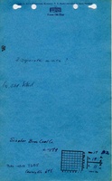
Mine Images

Photographs