3812: Difference between revisions
No edit summary |
No edit summary |
||
| Line 1: | Line 1: | ||
{{Sidebar Info Query}} | {{Sidebar Info Query}} | ||
{{Header | {{Header | ||
|checked= | |checked=Checked OK | ||
|unlocated=No | |unlocated=No | ||
|shown_on_map=Yes | |shown_on_map=Yes | ||
| Line 10: | Line 10: | ||
|mine_type=Underground | |mine_type=Underground | ||
|mined-out-area=None | |mined-out-area=None | ||
|indicated=No | |||
|county1=Vermilion | |county1=Vermilion | ||
|quad1=Danville SW | |quad1=Danville SW | ||
Latest revision as of 12:23, September 19, 2022
Mine Index Number: 3812
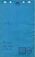
| Company Name: | Mary Kistler | ||
|---|---|---|---|
| Mine Name: | Kistler Mine | ||
| Start Date: | Unknown | End Date: | Unknown |
| Type of Mine: | Underground | ||
| Total acres shown: | None | ||
| Acres after map date: | General Area of mining acres shown: | ||
|
No production reported under this name; years of operation and production are unknown. May possibly be the same as Kistler and Bookman (in the unlocated mines of Vermilion County). | |||
Shaft, Slope, Drift or Tipple Location(s)
| Type | County | Township-Range | Section | Part Section |
|---|
| Mine | Vermilion | 19N 12W | 15 | SW NW NE |
Geology
| Thickness (ft) | |||||
|---|---|---|---|---|---|
| Seam | Depth (ft) | Min | Max | Ave | Mining Method |
| Danville | RP |
Geological Problems Reported
Production
| Company | Mine Name | Date | Production (tons) |
| Mary Kistler | Kistler | ||
Production Notes
Coal Report production (if available)
Sources of Data
| Source Map | Map Date | Original Scale | Digitized Scale | Map Type |
| Coal Section mine notes | Undated | 1:62500 | 1:24000 | Secondary source |
Annotated Bibliography (Data source - brief description of information)
| Directory of Illinois Coal Mines (Vermilion County) - Mine names, mine index, ownership. |
| Mine notes (Vermilion County) - Mine location, seam. |
Mine Notes
Mine Images
Photographs