4874: Difference between revisions
No edit summary |
No edit summary |
||
| Line 49: | Line 49: | ||
|Original Scale=1:62500 | |Original Scale=1:62500 | ||
|Digitized Scale=1:62500 | |Digitized Scale=1:62500 | ||
|Map Type=Secondary source | |||
}} | |||
{{Source Map | |||
|Source Map=State archive, MSHA_48_01 | |||
|Map Date=11-25-1937 | |||
|Original Scale=1:2400 | |||
|Digitized Scale=1:2400 | |||
|Map Type=Secondary source | |Map Type=Secondary source | ||
}} | }} | ||
{{Annotated bibliography header}} | {{Annotated bibliography header}} | ||
{{Annotated bibliography | |||
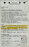
|bibliography=ISGS field notes (Perry County) - Mine location, mine type, depth, thickness. | |||
}} | |||
{{Annotated bibliography | |||
|bibliography=State archive, MSHA_48_01, map of Perfection Mine (mine index [[3156]]) - Mine outline. | |||
}} | |||
==Mine Notes== | ==Mine Notes== | ||
Revision as of 14:39, March 22, 2024
Mine Index Number: 4874
| Company Name: | Unknown | ||
|---|---|---|---|
| Mine Name: | Unknown Mine | ||
| Start Date: | Before 1934 | End Date: | Unknown |
| Type of Mine: | Underground | ||
| Total acres shown: | None | ||
| Acres after map date: | General Area of mining acres shown: | ||
|
Not Shown On Map. Not shown on the accompanying map because of later surface mining by Perfection Mine (mine index 3156). | |||
Shaft, Slope, Drift or Tipple Location(s)
| Type | County | Township-Range | Section | Part Section |
|---|
| Shaft | Perry | 6S 1W | 16 | NW SW NW |
Geology
| Thickness (ft) | |||||
|---|---|---|---|---|---|
| Seam | Depth (ft) | Min | Max | Ave | Mining Method |
Geological Problems Reported
Production
| Company | Mine Name | Date | Production (tons) |
Production Notes
Coal Report production (if available)
Sources of Data
| Source Map | Map Date | Original Scale | Digitized Scale | Map Type |
| ISGS field notes (E. T. Benson) | 8-28-1934 | 1:62500 | 1:62500 | Secondary source |
| State archive, MSHA_48_01 | 11-25-1937 | 1:2400 | 1:2400 | Secondary source |
Annotated Bibliography (Data source - brief description of information)
| ISGS field notes (Perry County) - Mine location, mine type, depth, thickness. |
| State archive, MSHA_48_01, map of Perfection Mine (mine index 3156) - Mine outline. |
Mine Notes
Mine Images
![[[:Perfection|Perfection]]](https://wikiimage.isgs.illinois.edu/ilmines/perry/thumbnails/m3156_MSHA_48_01_th.jpg)
Photographs