Category:Perry-County
County Coal Data
Mines that Appear in Perry-County
- 9998 & 9999 = Unknown dates
Unlocated Mines in Perry-County
Mine that have known coal production but no known location
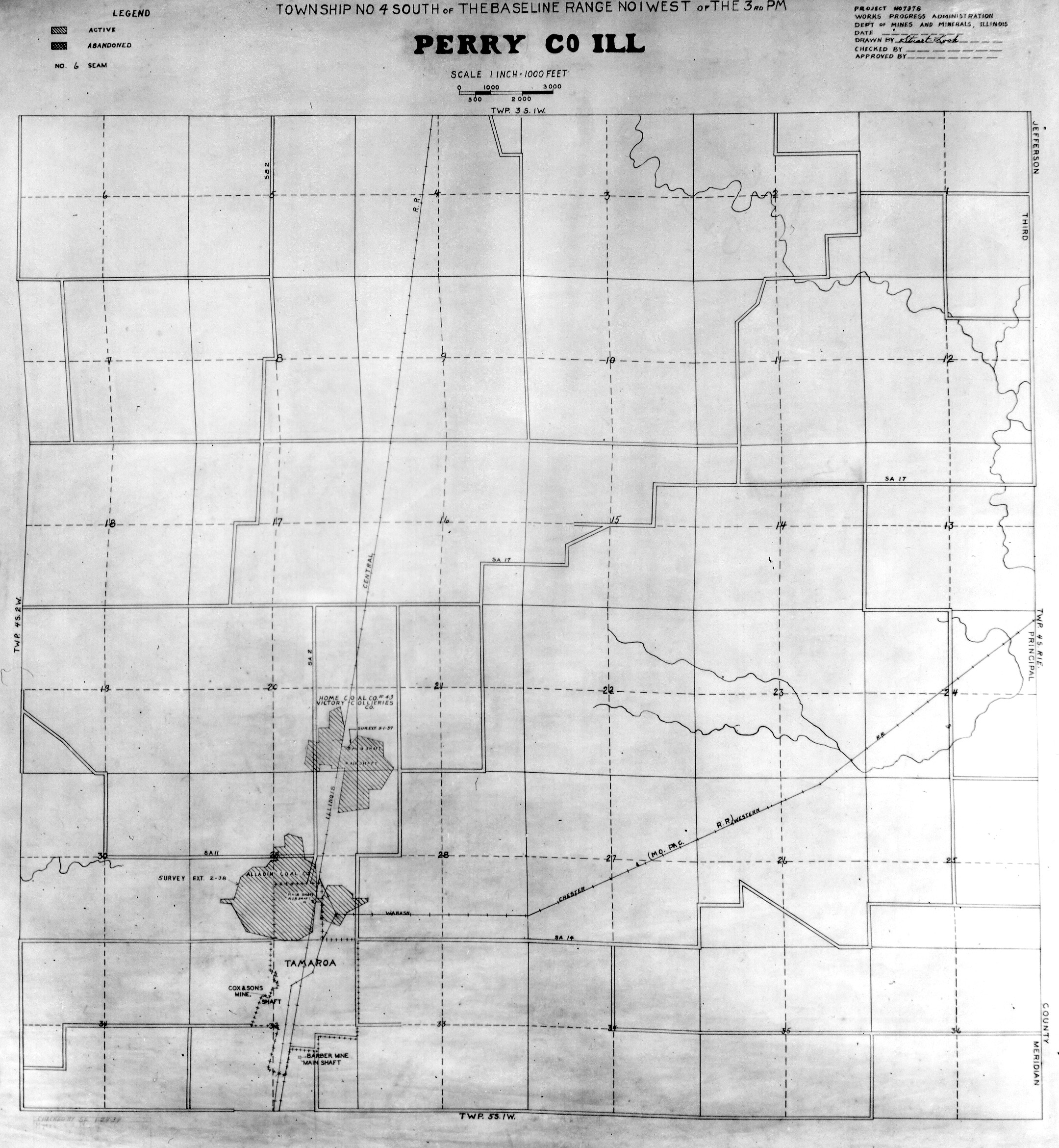
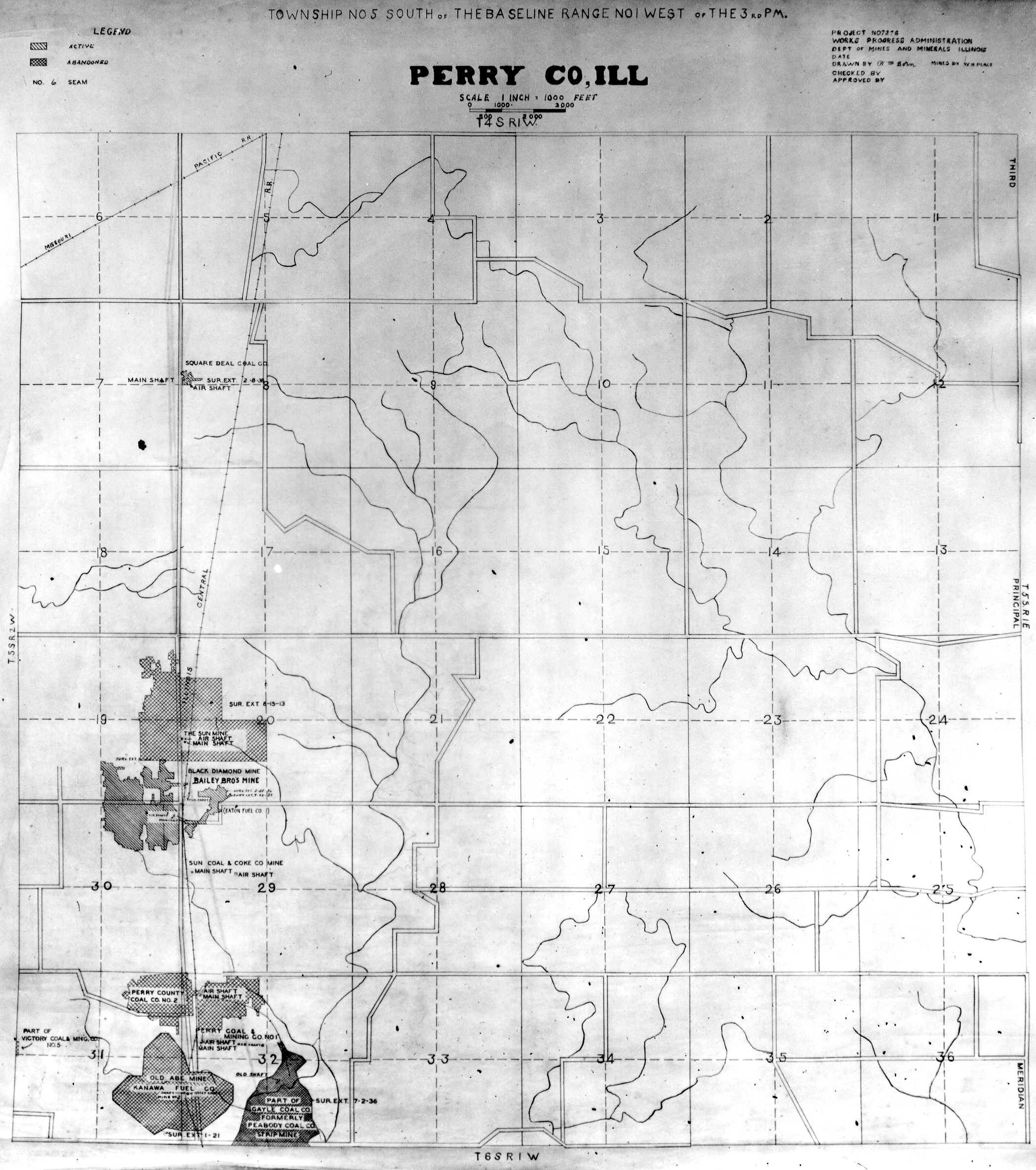
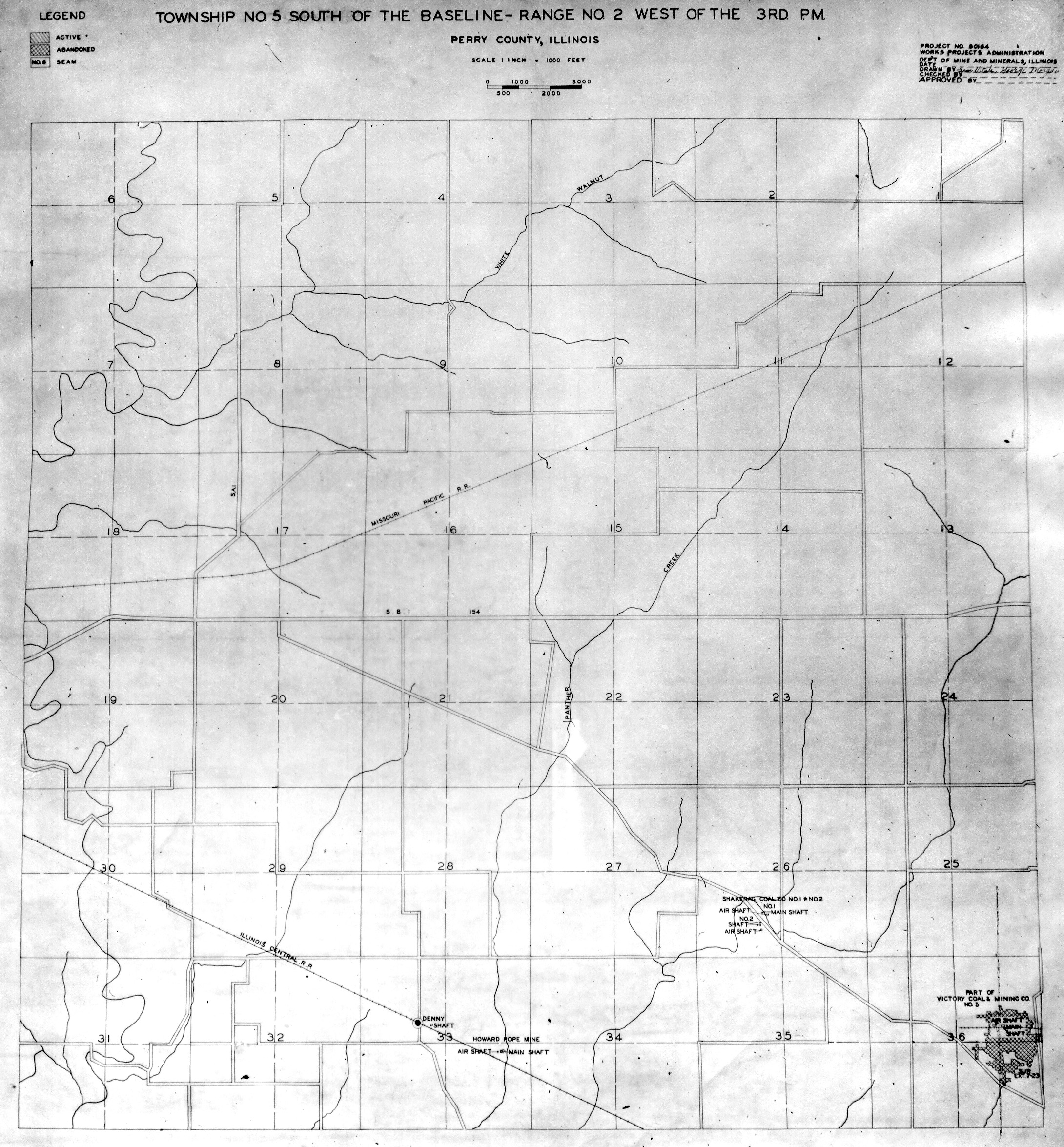
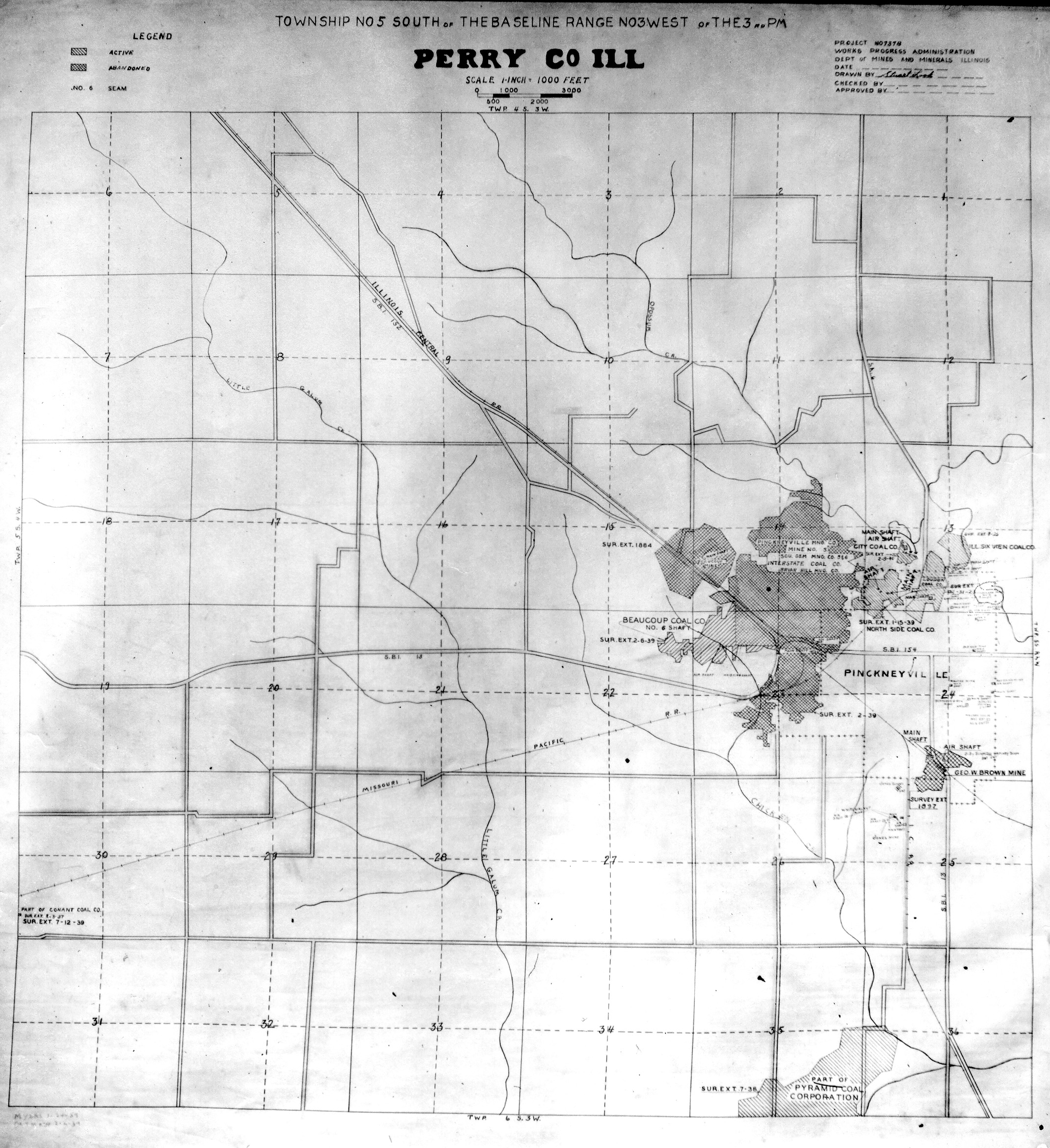
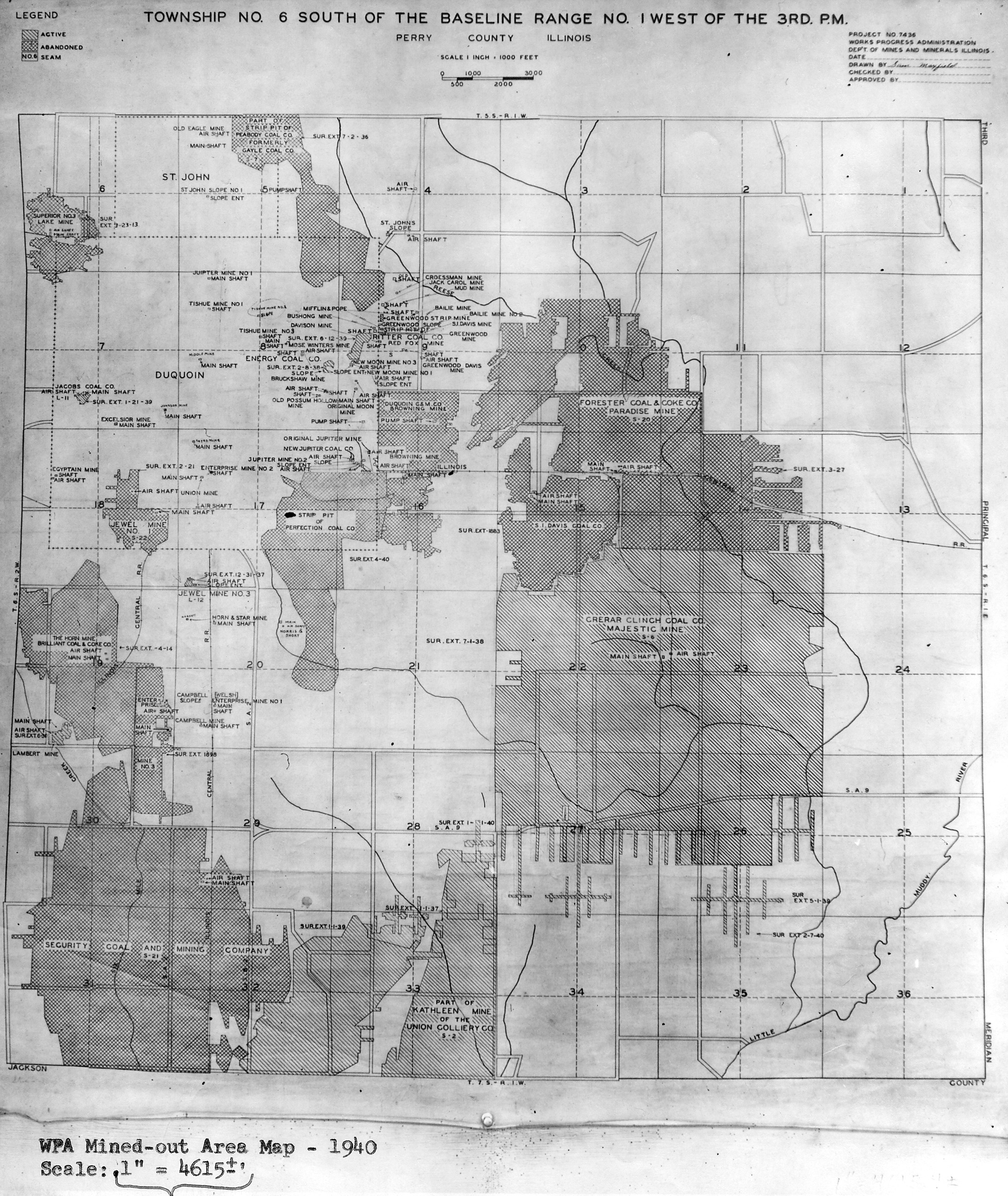
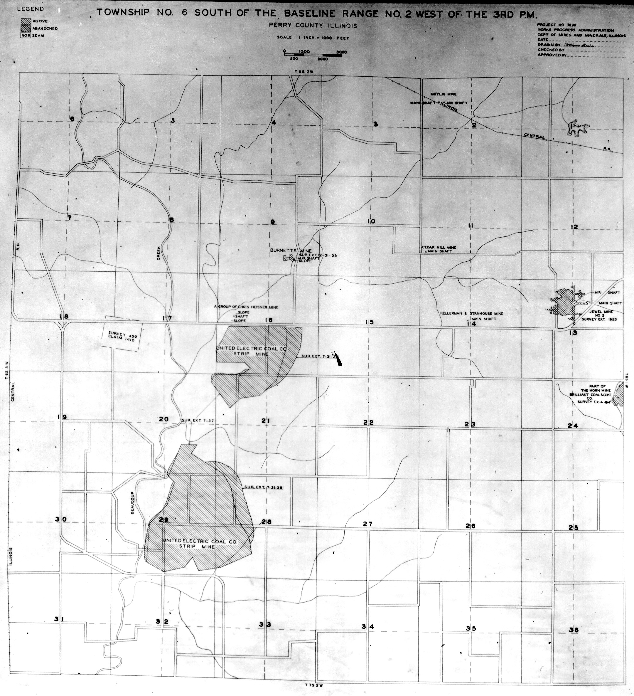
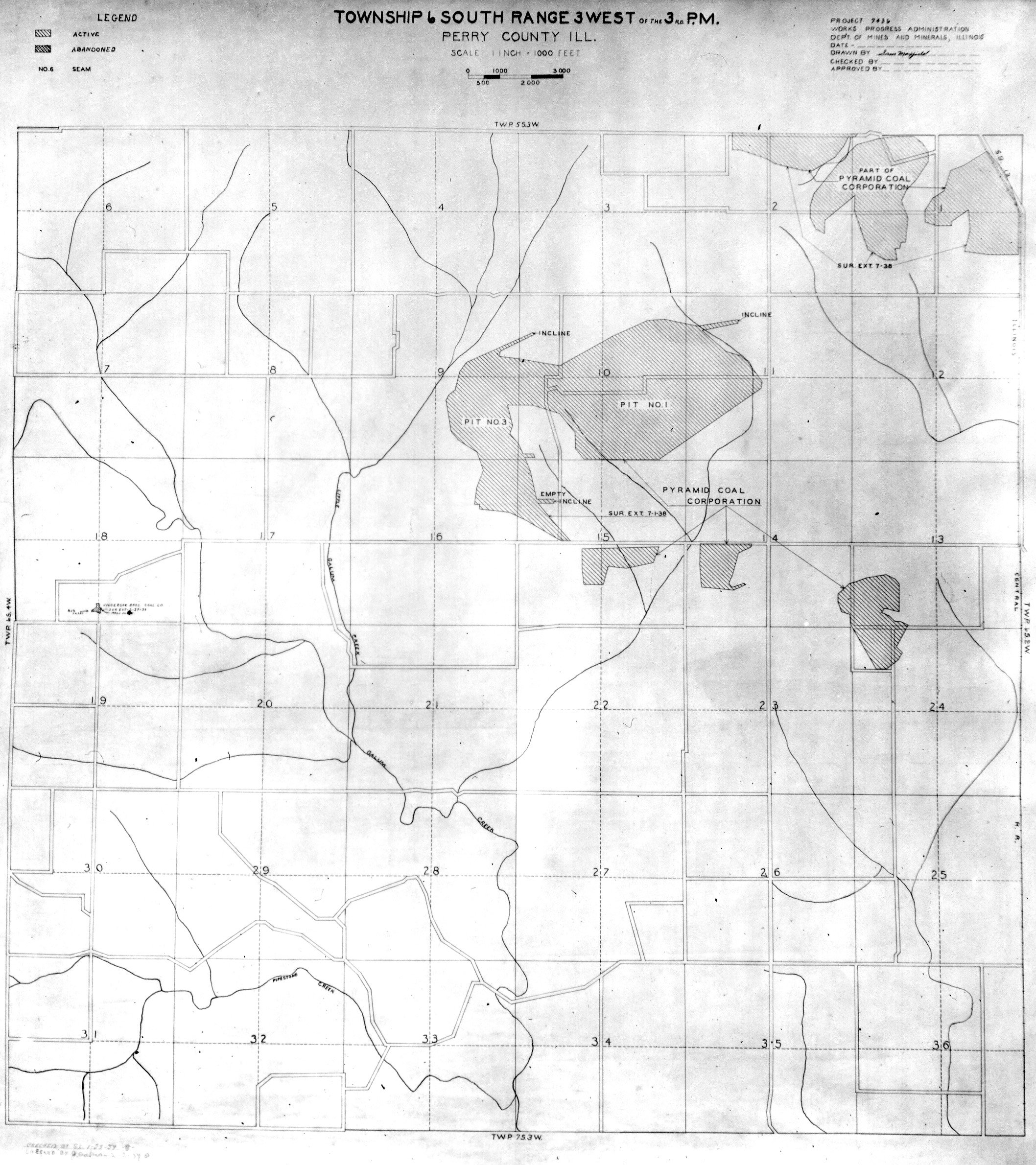
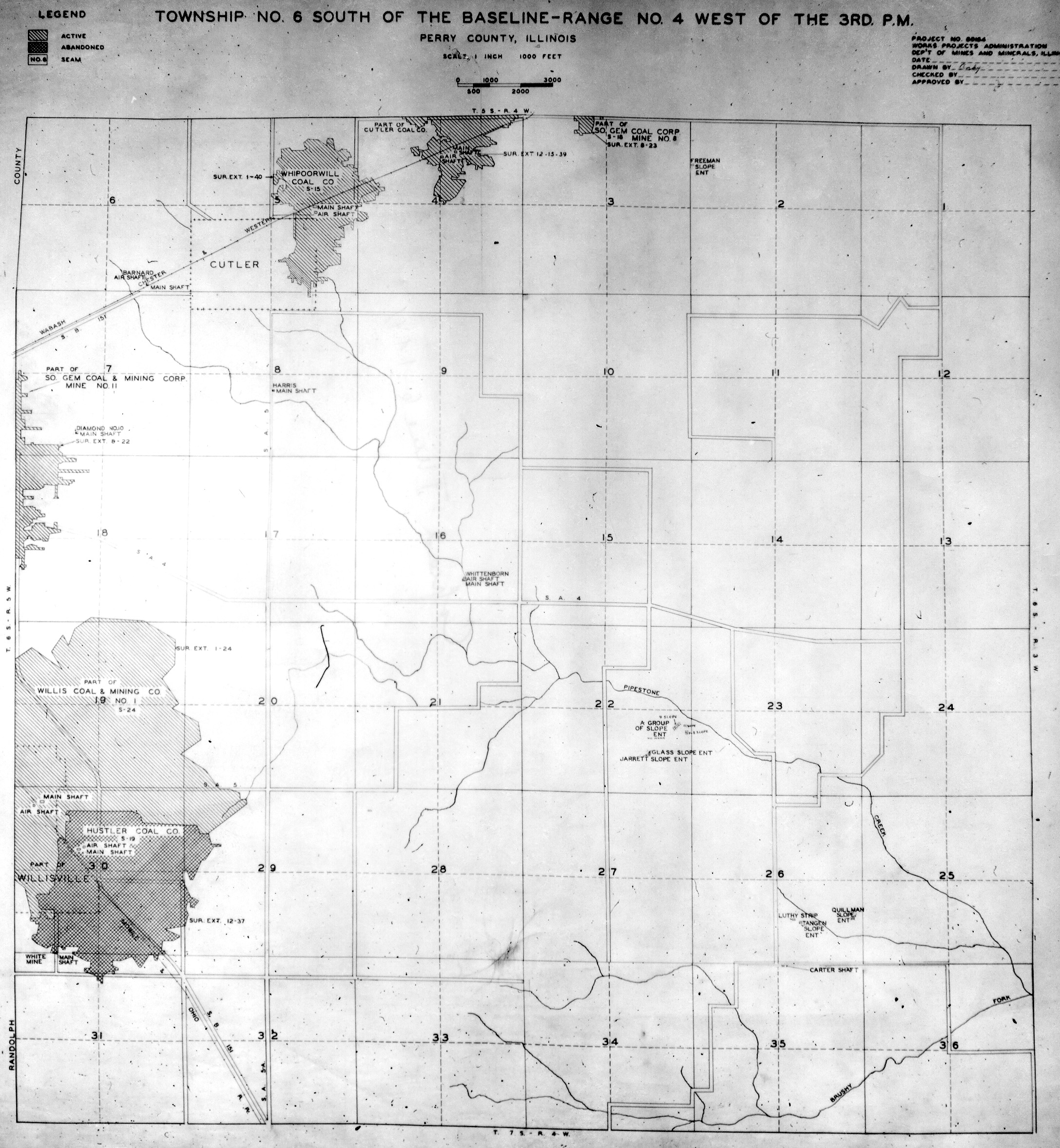
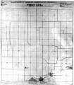
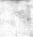
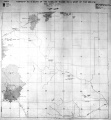
Historical Mined Out Area Maps
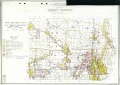
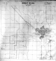
WPA
These maps were constructed as part of the nationwide Works Projects Administration (WPA), generally between 1934 and 1937 with some later updates or revisions,
Disclaimer
Maps for some locations might have multiple versions/seams, please inspected these areas closely for differences.
Notes and corrections were made by ISGS staff.
These maps are reproductions from microfilm, they may be of poor quality with text difficult to read.


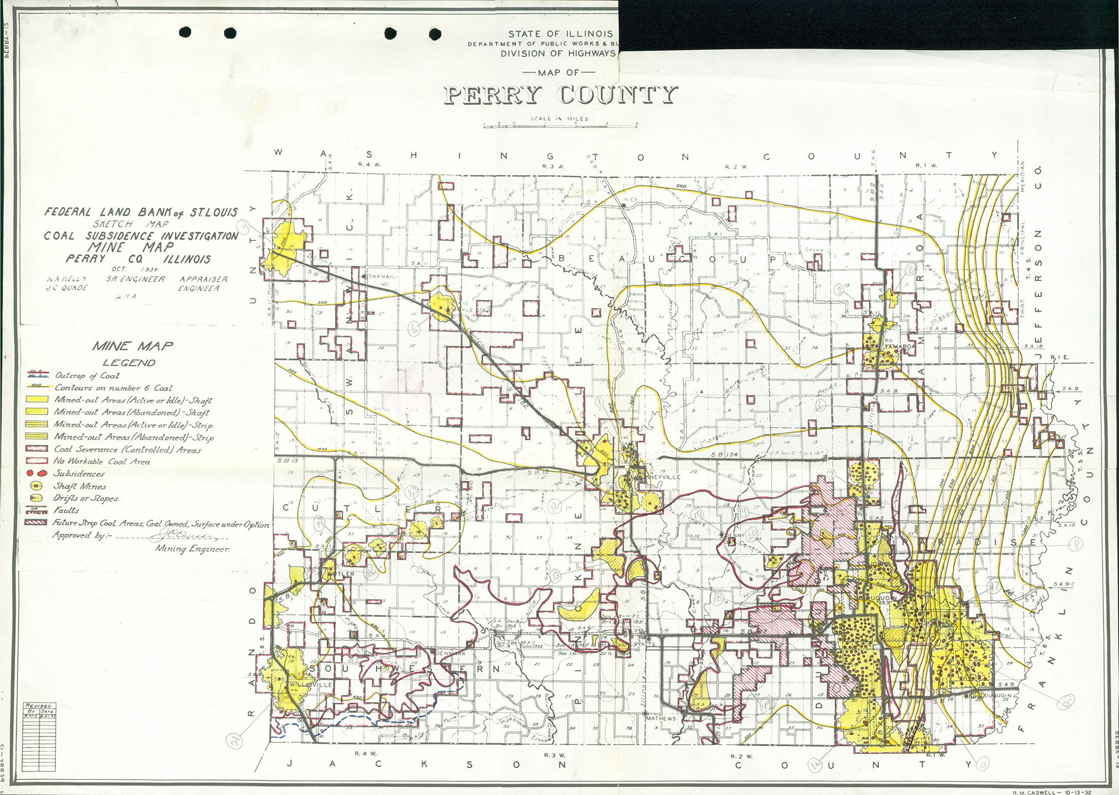
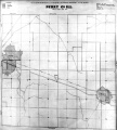
Federal Land Bank of St. Louis, Preliminary Reports on Subsidence Investigations
Federal Land Bank of St. Louis, Preliminary Reports on Subsidence Investigations (refered by Coal Section Staff as "Quade Maps")
Mining engineers working for the Federal Land Bank of St. Louis mapped areas of subsidence due to coal mining in the early 1930s. These reports often include county maps of mine properties with mined-out areas including shaft locations, as well as subsidence areas.
Disclaimer
Maps for some locations might have multiple versions/seams, please inspected these areas closely for differences.
These maps are accompanied by a report, please download and inspect this document.
Notes and corrections were made by ISGS staff.

Photographs


Pages in category "Perry-County"
The following 179 pages are in this category, out of 179 total.
0
3
- 3105
- 3106
- 3107
- 3108
- 3109
- 3110
- 3111
- 3112
- 3113
- 3114
- 3115
- 3118
- 3120
- 3121
- 3123
- 3124
- 3125
- 3126
- 3127
- 3128
- 3129
- 3130
- 3131
- 3132
- 3133
- 3134
- 3135
- 3136
- 3137
- 3138
- 3139
- 3140
- 3142
- 3143
- 3145
- 3146
- 3147
- 3148
- 3149
- 3151
- 3153
- 3154
- 3155
- 3156
- 3157
- 3158
- 3159
- 3160
- 3161
- 3162
- 3163
- 3164
- 3165
- 3166
- 3167
- 3168
- 3169
- 3171
- 3172
- 3173
- 3174
- 3175
- 3176
- 3177
- 3178
- 3180
- 3181
- 3253
4
6
Media in category "Perry-County"
The following 19 files are in this category, out of 19 total.
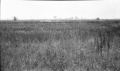 M-962 Sunfield mine Duquoin sag foreground and background high grass over pillar.jpg 4,376 × 2,586; 1.36 MB
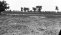
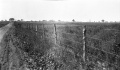 M-963 Majestic Mine-Duquoin sag quarter mile long fence shows sag of about 2ft.jpg 4,366 × 2,554; 1.28 MB
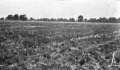 M-965 Paradise Mine E of Duquoin NW of shaft 800ft across 3ft deep some wtr.jpg 4,344 × 2,539; 1.21 MB
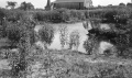 M-966 sink over two rooms E of Security shaft E of ICRR S of Duquoin.jpg 4,365 × 2,570; 1.48 MB
 M-967 Sunfield Mine typical Duquoin sag.jpg 4,355 × 2,541; 1.3 MB
 M1036 minenotes.pdf 922 × 1,277, 5 pages; 1.32 MB
 M1045 minenotes.pdf 1,285 × 1,662, 6 pages; 4.59 MB
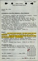 M4874 fieldnotes.pdf 752 × 1,197; 298 KB
 QUADE PERRY.jpg 2,200 × 1,564; 1.22 MB
 WPA PERRY 4S1W.jpg 2,160 × 2,340; 1.32 MB
 WPA PERRY 4S4W.jpg 1,760 × 1,960; 1.06 MB
 WPA PERRY 5S1W.jpg 2,100 × 2,373; 1.47 MB
 WPA PERRY 5S2W.jpg 2,180 × 2,350; 1.5 MB
 WPA PERRY 5S3W.jpg 2,140 × 2,340; 1.42 MB
 WPA PERRY 5S4W.jpg 1,780 × 2,040; 1.08 MB
 WPA PERRY 6S1W.jpg 2,172 × 2,577; 1.62 MB
 WPA PERRY 6S2W.jpg 2,160 × 2,370; 1.34 MB
 WPA PERRY 6S3W.jpg 2,116 × 2,380; 1.32 MB
 WPA PERRY 6S4W.jpg 2,175 × 2,356; 1.35 MB